Near Saugatuck in Allegan County, Michigan — The American Midwest (Great Lakes)
Welcome to River Bluff Park
Historic Saugatuck Township
— Allegan County Heritage Trail —
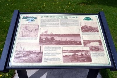
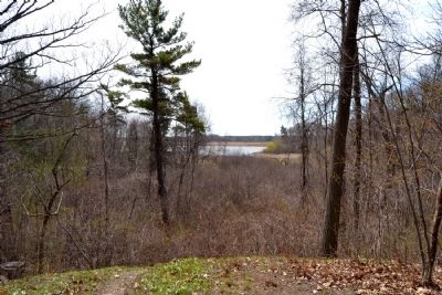
You are near the center of Historic Saugatuck Township in River Bluff Park. The first settlers came here to a howling wilderness in the early 1830's. Within the township, Saugatuck is a half-mile to the west on the Old Allegan Road. Across the river to the south on the Blue Star Highway lies Douglas. Seven serene miles upstream, in Manlius Township, lies the village of New Richmond. The Kalamazoo River, visible through the trees to the south, flows into Lake Michigan four miles to the northwest at the old lumber mill town of Singapore, long vanished beneath the dunes.
The huge White Pine forest was cut, floated, milled and shipped off in lumber schooners to build the new frontier towns. Abundant stands of white oak enabled the early Saugatuck shipbuilders to flourish for fifty years. By 1875, the lumbering business was gone, replaced by the growing of peaches. Orchards dotted the countryside. At one time, there were 10,000 peach trees in the Village of Douglas. The lumber mill in Douglas then turned to making fruit baskets and business boomed for forty years.
The crossing of the river near here has a long history. In early years, it was accomplished by boarding the ferry near the center of Saugatuck. Then the first bridge was built in 1871, a half mile southwest of this spot - the same area it occupies today. Part island, part wooden planks on pilings, a short section on the Douglas side was at first a drawbridge, then in 1906, a swing bridge. The Blue Star span was first built in 1936 and the I-196 freeway bridge was completed in 1964.
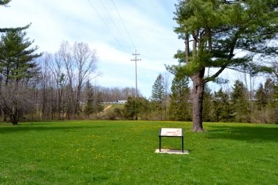
The land for this park was obtained from the State of Michigan when excess land acquired for the building of the freeway was sold to Saugatuck Township in 1968. The park was created by the Township on a parcel of about 25 acres, which includes about 2500' of river frontage.
The road to Allegan was traveled by stagecoach and wagon in early years. A more scenic and comfortable method of travel was by riverboat. When the railroad came through New Richmond in 1871, this further encouraged riverboat travel. River to stream, boom to bust, many operators tried to make a success of this business but few succeeded for the water level fluctuated with the level of Lake Michigan.
For a hundred years visitors have come to enjoy the big lake breeze, to paint and photograph the charm, to fish the Kalamazoo and most of all to savor the history of this unique place called Saugatuck.
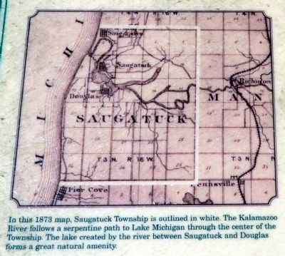
(Upper Left Map Caption)
In this 1873 map, Saugatuck Township is outlined in white. The Kalamazoo River follows a serpentine path to Lake Michigan through the center of the Township. The lake created by the river between Saugatuck and Douglas
forms a great natural amenity.
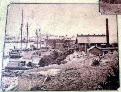
(Lower Left Image Caption)
ca 1869. The lumber schooner O.R. Johnson was loading and Singapore was busy with two mills operating. In six years the boom was over and the Johnson mill was dismantled and moved to St. Ignace in the Upper Peninsula where the timber crop was to be harvested.
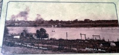
(Center Image Caption)
ca 1910. This photo panorama was taken from the east end of Center Street in downtown Douglas. You are on the opposite side of the river from where the photographer stood. The riverboat, A.R. Heath, billowing smoke in the main river channel, is headed for New Richmond. The river here widened into a bayou area. The small dock in the foreground was the landing for the passenger ferry to Saugatuck.
(Upper Right Image Caption)
ca 1905. The scene is the Douglas Basket Factory on the river bank just above the bridge. Hardwood logs boomed down the river and became the primary raw material used to make baskets and crates. The completed product was then shipped by water to the railroad in New Richmond and by streamer to other lake Michigan ports.
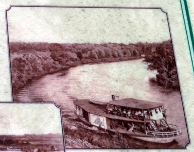
(Middle Right Image Caption)
ca 1905. The A.R. Heath was a wide and stubby side-wheeler that drew less than a foot of water. It is seen here between Douglas and New Richmond carrying passengers and freight. Launched in
1901, it was touted as the best shallow water steamer ever. In twelve years, it was abandoned on the riverbank in Saugatuck.
(Lower Right Image Caption)
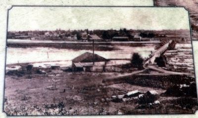
ca 1895. Looking across the bridge to Douglas, note the 1871 bridge, the logs floating beside it and the basket factory complex on the far side. The 1936 bridge was built fifty yards upstream and included the existing approach, which required a large amount of fill material dredged from the river bottom.
Erected by Allegan County Tourist Council and Charles and Betsy Hill. (Marker Number Stop 19.)
Topics. This historical marker is listed in these topic lists: Bridges & Viaducts • Industry & Commerce • Settlements & Settlers • Waterways & Vessels. A significant historical year for this entry is 1875.
Location. 42° 39.224′ N, 86° 11.015′ W. Marker is near Saugatuck, Michigan, in Allegan County. Marker can be reached from Old Allegan Road, 0.1 miles west of New Richmond Road. Marker is located in River Bluff Park. Touch for map. Marker is in this post office area: Saugatuck MI 49453, United States of America. Touch for directions.
Other nearby markers. At least 8 other markers are within 2 miles of this marker, measured as the crow flies. The Allegan Road (about 300 feet away, measured in a direct line); All Saints Episcopal Church / Gordon W. Lloyd (approx. 0.9 miles away); First Congregational Church (approx. one mile away); Reed's Livery (approx. one mile away); Singapore, Michigan (approx. one mile away); Saugatuck Engine House (approx. one mile away); New Singapore (approx. 1.1 miles away); Dutcher Lodge No. 193 / Douglas (approx. 1.2 miles away). Touch for a list and map of all markers in Saugatuck.
More about this marker. The marker is at Site #19 of the Allegan County Heritage Trail.
Also see . . . Allegan County Heritage Trail Tour. Allegan County website entry (Submitted on May 11, 2014.)
Credits. This page was last revised on August 5, 2023. It was originally submitted on May 11, 2014, by Duane Hall of Abilene, Texas. This page has been viewed 653 times since then and 24 times this year. Photos: 1, 2, 3, 4, 5, 6, 7, 8, 9, 10. submitted on May 11, 2014, by Duane Hall of Abilene, Texas.
