Near Muleshoe in Bailey County, Texas — The American South (West South Central)
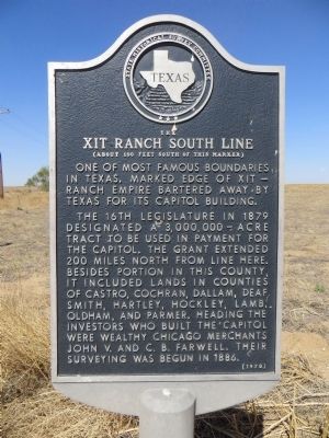
XIT Ranch South Line
(About 100 feet south of this marker)
The 16th Legislature in 1879 designated a 3,000,000-acre tract to be used in payment for the Capitol. The grant extended 200 miles north from line here. Besides portion in this county, it included lands in counties of Castro, Cochran, Dallam, Deaf Smith, Hartley, Hockley, Lamb, Oldham, and Parmer. Heading the investors who built the Capitol were wealthy Chicago merchants, John V. and C.B. Farwell. Their surveying was begun in 1886.
Erected 1970 by State Historical Survey Committee. (Marker Number 5456.)
Topics. This historical marker is listed in these topic lists: Agriculture • Government & Politics. A significant historical year for this entry is 1879.
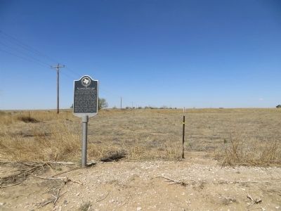
Location. 34° 10.905′ N, 102° 44.016′ W. Marker is near Muleshoe, Texas, in Bailey County. Marker is at the intersection of State Highway 214 and County Route 1090, on the left when traveling north on State Highway 214. Touch for map. Marker is in this post office area: Muleshoe TX 79347, United States of America. Touch for directions.
Other nearby markers. At least 8 other markers are within 8 miles of this marker, measured as the crow flies. Bailey County (approx. 3 miles away); The Founding of Bailey County (approx. 3 miles away); The Mule (approx. 3.1 miles away); Quanah Parker Trail (approx. 4 miles away); Old Muleshoe Ranch Cookhouse (approx. 4 miles away); Old Hurley (approx. 5.7 miles away); Harden A. Douglass (approx. 7˝ miles away); Bailey County Cemetery (approx. 7˝ miles away). Touch for a list and map of all markers in Muleshoe.
Credits. This page was last revised on August 27, 2020. It was originally submitted on May 13, 2014, by Bill Kirchner of Tucson, Arizona. This page has been viewed 962 times since then and 48 times this year. Photos: 1, 2. submitted on May 13, 2014, by Bill Kirchner of Tucson, Arizona. • Bernard Fisher was the editor who published this page.

