Otsego in Allegan County, Michigan — The American Midwest (Great Lakes)
Welcome to the City of Otsego
Otsego: A Town with a History
— Allegan County Heritage Trail —
Dr. Samuel Foster and his family built the first frame structure just west of here on the banks of the Kalamazoo River in the fall of 1831. First called “Allegan,” the name was changed officially to Otsego in 1835 when land developer Horace Comstock of Otsego County, New York purchased much of what is now the downtown area and established a post office here.
A dam and mill race were built in the late 1830s and also by that time a lumber and grist mill and several retail businesses had been established. Several hotels including The Exchange, Tompkins House, and The Hotel Revere all served visitors to the area. Furniture was sent to points throughout the Midwest by the Otsego Chair Company (1871-ca through 1915) and shoes were made for over three decades at the Eady Shoe Factory located on nearby Helen Avenue.
Beginning in 1887, the town entered into the paper industry with the construction of the Bardeen Paper Mill. By 1907, Otsego would have seven paper mills in operation, all taking advantage of the power and convenience of the Kalamazoo River.
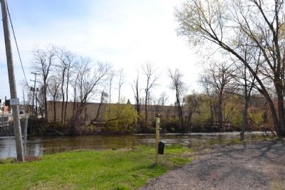
The island in the middle of the river east of the Farmer Street bridge held a popular park for many years. Due to excessive flooding and the dangers of getting to the isle, the park was closed in the 1920s.
The location of this historical tour sign marks the site of Otsego’s Mineral Springs Bathhouse, a business that thrived from 1870-1887.
(Image Captions)
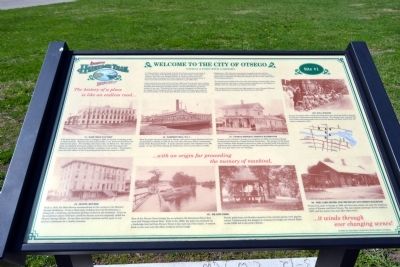
1931 Doll Parade
As part of Otsego’s 1931 Centennial Celebration, four hundred children dressed in costumes commemorating America’s history. The Otsego Union reported that over twenty thousand people came to see the parade and other events that 4th of July weekend in 1931.
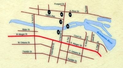
#1 - Eady Shoe Factory
E.W. Eady began making shoes in Otsego in 1903, his factory occupying a site on Helen Avenue. Business thrived and by 1910, a new three-story factory was added to the plant. This building still exists today on Helen Ave. The factory made and shipped thousands of pairs of shoes every week throughout the Midwest and nearly one-third of Eady’s employees were women. The business survived until effects of the Great Depression forced its closure in 1935.
#2 - Bardeen Mill No. 2
With the paper business booming in Otsego, mill owner George Bardeen built his second plant in Otsego in 1891 on the west side of Farmer Street, immediately south of the Kalamazoo River. It made specialty papers and employed over 100 people. It was shut down during the Depression and was torn down in 1935.
#3 - Otsego Mineral Springs Bathhouse
As soon as the railroad to Otsego was completed in 1869, several local Otsego businessmen formed the Otsego Business Association. The purpose of the group was to combine their financial resources in order to quickly building and operate a bathhouse that utilized the spring waters that percolated from the ground near this very spot where you are standing.
#4 - Hotel Revere
Built in 1870, the Hotel Revere accommodated all the visitors to the Mineral Springs Bathhouse. It was a three-story building that had 30 bedrooms, a dining hall, a ballroom, and kitchen facilities located in the basement. It sat on the southwest corner of Farmer and River Streets and was originally called the Mineral Springs House. Its top floor was later removed and for years it was used as a storeroom for a lumber business.
#5 - Island Park
East of the Farmer Street bridge lies an island in the Kalamazoo River that once held Otsego’s Island Park. Built in the 1880s, the park was accessed via a footbridge that led from Farmer Street to the west tip of the island. A cement block on the west end still offers evidence of that bridge.
Family gatherings and Sunday concerts at the island’s gazebo were popular events. Unfortunately, the dangers in crossing the bridge and several floods in the 1920s led to the park’s demise.
#6 - The Lake Shore and Michigan Southern Railroad
Trains first came to Otsego in 1869
and this train station sat near the southeast corner of Farmer and River Streets. The last regular passenger service ended in 1937, and the station was soon after taken down.
Erected by Otsego Downtown Development Authority. (Marker Number Stop 1.)
Topics. This historical marker is listed in these topic lists: Industry & Commerce • Settlements & Settlers. A significant historical year for this entry is 1831.
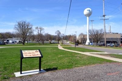
Location. 42° 27.768′ N, 85° 41.784′ W. Marker is in Otsego, Michigan, in Allegan County. Marker can be reached from N. Farmer Street south of Helen Avenue, on the left when traveling north. Marker is located in front of the City of Otsego Publc Works Department maintenance facility near the Kalamazoo River. Touch for map. Marker is in this post office area: Otsego MI 49078, United States of America. Touch for directions.
Other nearby markers. At least 8 other markers are within 8 miles of this marker, measured as the crow flies. Otsego Methodist Church (approx. 0.2 miles away); Otsego Civil War Memorial (approx. 0.3 miles away); Welcome to Pine Creek (approx. 1.9 miles away); Michigan Paper Company Mill (approx. 3 miles away); Soule Memorial Fountain (approx. 3.1 miles away); Early History of Martin (approx. 5.8 miles away); Geib Veterans Memorial (approx. 6 miles away); Cooper Congregational Church (approx. 7.3 miles away). Touch for a list and map of all markers in Otsego.
Also see . . .
Allegan County Heritage Trail. Allegan County website entry (Submitted on May 16, 2014.)
Credits. This page was last revised on August 5, 2023. It was originally submitted on May 16, 2014, by Duane Hall of Abilene, Texas. This page has been viewed 1,332 times since then and 85 times this year. Photos: 1, 2, 3, 4. submitted on May 16, 2014, by Duane Hall of Abilene, Texas.


