Norseland in Nicollet County, Minnesota — The American Midwest (Upper Plains)
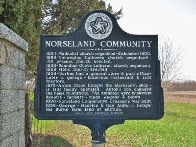
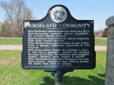
Norseland Community
1854-Methodist church organized-disbanded 1900.
1858-Norwegian Lutheran church organized - 1911 present church erected.
1858-Scandian Grove Lutheran church organized. 1888 stone church erected.
1858-Burkes had a general store & post office-Later a garage - luxurious restaurant & sold tractors.
1875-Anton Olson bought the blacksmith shop - is still family operated. Anton’s son changed the name to Anthony. The Anthonys were implement dealers - farmers - made wagons & plows.
1896-Norseland Cooperative Creamery was built.
1939-George - Maurice & Ray Anthony bought the Burke farm land at auction.
Erected 1976 by the Nicollet County Bicentennial Commission.
Topics and series. This historical marker is listed in this topic list: Settlements & Settlers. In addition, it is included in the The Spirit of ’76, America’s Bicentennial Celebration series list. A significant historical year for this entry is 1900.
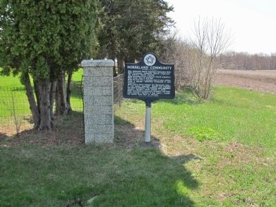
Location. 44° 24.593′ N, 94° 6.739′ W. Marker is in Norseland, Minnesota, in Nicollet County. Marker is on State Highway 22, 0.4 miles east of County Road 52, on the right when traveling east. Marker is located immediately northwest of the old Scandian Grove Cemetery, 8¼ miles northwest of St. Peter. Touch for map. Marker is in this post office area: Saint Peter MN 56082, United States of America. Touch for directions.
Other nearby markers. At least 8 other markers are within 8 miles of this marker, measured as the crow flies. A different marker also named Norseland Community (a few steps from this marker); New Sweden Indian Attack (within shouting distance of this marker); a different marker also named Norseland Community (approx. 0.2 miles away); Norseland Lutheran Church (approx. 0.4 miles away); Scandian Grove Evangelical Lutheran Church (approx. 0.8 miles away); District 6 School (approx. 2.8 miles away); New Sweden Creamery (approx. 3.8 miles away); Old Traverse Cemetery (approx. 7.2 miles away). Touch for a list and map of all markers in Norseland.
Also see . . . Norseland, Minnesota. Wikipedia entry. (Submitted on May 21, 2014.)
Credits. This page was last revised on June 16, 2016. It was originally submitted on May 21, 2014, by Keith L of Wisconsin Rapids, Wisconsin. This page has been viewed 510 times since then and 16 times this year. Photos: 1, 2, 3. submitted on May 21, 2014, by Keith L of Wisconsin Rapids, Wisconsin.


