Mount Sterling in Montgomery County, Kentucky — The American South (East South Central)
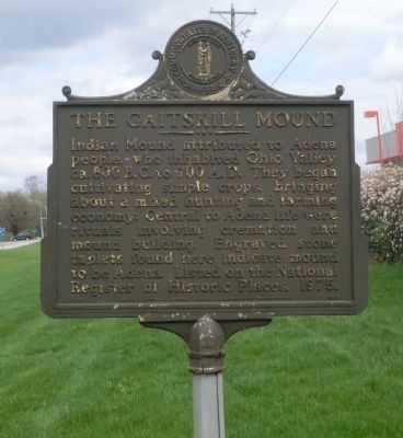
The Gaitskill Mound
Erected 1979 by Kentucky Historical Society-Kentucky Department of Highways. (Marker Number 1655.)
Topics and series. This historical marker is listed in this topic list: Anthropology & Archaeology. In addition, it is included in the Kentucky Historical Society series list. A significant historical year for this entry is 1975.
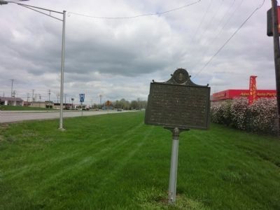
Location. 38° 4.398′ N, 83° 57.066′ W. Marker is in Mount Sterling, Kentucky, in Montgomery County. Marker is on Indian Mound Drive. Touch for map. Marker is in this post office area: Mount Sterling KY 40353, United States of America. Touch for directions.
Other nearby markers. At least 8 other markers are within 2 miles of this marker, measured as the crow flies. Estill's Defeat (approx. 0.6 miles away); Montgomery County Veterans Memorial (approx. 1.2 miles away); Battle of Mt. Sterling (approx. 1.2 miles away); Montgomery County World War II Memorial (approx. 1.2 miles away); Montgomery County Kentucky World War I Memorial (approx. 1.2 miles away); Montgomery County Korean War Memorial (approx. 1.2 miles away); Montgomery County Kentucky Vietnam Casualties (approx. 1.2 miles away); Courthouse Burned (approx. 1.2 miles away). Touch for a list and map of all markers in Mount Sterling.
Credits. This page was last revised on June 16, 2016. It was originally submitted on May 20, 2014, by Don Morfe of Baltimore, Maryland. This page has been viewed 985 times since then and 75 times this year. Last updated on May 21, 2014, by Keith S Smith of West Chester, Pennsylvania. Photos: 1, 2. submitted on May 20, 2014, by Don Morfe of Baltimore, Maryland. • Bill Pfingsten was the editor who published this page.

