Doswell in Hanover County, Virginia — The American South (Mid-Atlantic)
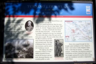
Turning Lee’s Flank
Battle of North Anna River
— 1864 Overland Campaign —
Lee’s health declined just when his army needed him the most. His son Capt. Robert “Rob” E. Lee, Jr., worried, “Suppose disease should disable him, … or, worse, should take him forever from the front of his men! … It was too awful to consider.” Confined to his tent, Lee muttered, “We must strike them a blow. We must not let them pass us again. We must strike them a blow.” On May 27, however, the Federals turned Lee’s flank again and marched south. The siege of Richmond that Lee feared was imminent, and the end of the Confederacy loomed.
The fighting also affected nearby civilians as Union soldiers plundered houses, carried off furniture and artwork, destroyed libraries, and scrawled graffiti on walls.
Slaves who escaped through the lines brought useful intelligence to Gen. Ulysses S. Grant. “Lee’s army is really whipped,” Grant wrote. “I feel that our success … is already assured.” A week later, the disastrous assault at Cold Harbor on June 3 dashed his hopes, and the struggle continued for another eleven months until the Confederate surrender at Appomattox Court House.
(captions)
(upper left) Gen. Robert E. Lee Courtesy Library of Congress
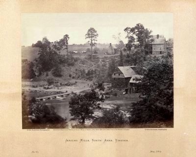
(lower left) Jericho Mill on the North Anna River, 1864 — Courtesy Library of Congress
(lower right) Gen. Ulysses S. Grant Courtesy Library of Congress
Erected 2014 by Virginia Civil War Trails.
Topics and series. This historical marker is listed in this topic list: War, US Civil. In addition, it is included in the Virginia Civil War Trails series list. A significant historical month for this entry is May 1902.
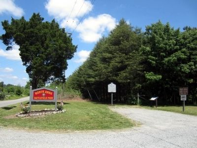
Location. 37° 52.733′ N, 77° 30.309′ W. Marker is in Doswell, Virginia, in Hanover County. Marker is on Verdon Road (Virginia Route 684) 0.2 miles west of New Market Mill Road (Virginia Route 685), on the right when traveling west. Touch for map. Marker is at or near this postal address: 11576 Verdon Rd, Doswell VA 23047, United States of America. Touch for directions.
Other nearby markers. At least 8 other markers are within walking distance of this marker. Attack at Ox Ford (here, next to this marker); The Fight for North Anna / The North Anna Battlefield (approx. 0.4 miles away); Dead of the North Anna Battlefield (approx. 0.4 miles away); The Ox Ford Road (approx. half a mile away); Colonel Weisiger's Virginians (approx. half a mile away); Battle on the Skirmish Line (approx. 0.6 miles away); One Brigade Alone (approx. 0.6 miles away); The Heart of Dixie (approx. 0.7 miles away). Touch for a list and map of all markers in Doswell.
Also see . . . North Anna Battlefield Park. Hanover County Parks & Recreation (Submitted on July 3, 2014.)
Credits. This page was last revised on November 30, 2017. It was originally submitted on May 24, 2014, by Bernard Fisher of Richmond, Virginia. This page has been viewed 991 times since then and 27 times this year. Photos: 1, 2, 3, 4. submitted on May 24, 2014, by Bernard Fisher of Richmond, Virginia.


