Dowelltown in Dekalb County, Tennessee — The American South (East South Central)
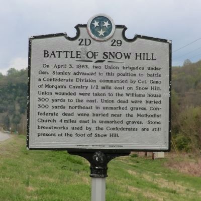
Battle of Snow Hill
Erected by Tennessee Historical Commission. (Marker Number 2D 29.)
Topics and series. This memorial is listed in this topic list: War, US Civil. In addition, it is included in the Tennessee Historical Commission series list.
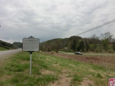
Location. 36° 0.318′ N, 85° 55.65′ W. Marker is in Dowelltown, Tennessee, in Dekalb County. Memorial is at the intersection of Nashville Highway (U.S. 70) and Old Dry Creek Road, on the right when traveling east on Nashville Highway. Touch for map. Marker is in this post office area: Dowelltown TN 37059, United States of America. Touch for directions.
Other nearby markers. At least 8 other markers are within 8 miles of this marker, measured as the crow flies. Adam Dale (approx. 2.1 miles away); Beckwith Inn (approx. 4.4 miles away); Morgan's Ohio Raid (approx. 6.9 miles away); DeKalb County Confederate Monument (approx. 7.1 miles away); Veterans Memorial DeKalb County Tennessee (approx. 7.1 miles away); Dekalb County (approx. 7.1 miles away); DeKalb County in the Civil War (approx. 7.1 miles away); Darrin Vincent (approx. 7.1 miles away).
Credits. This page was last revised on January 20, 2020. It was originally submitted on June 10, 2014, by Don Morfe of Baltimore, Maryland. This page has been viewed 1,795 times since then and 164 times this year. Photos: 1, 2. submitted on June 10, 2014, by Don Morfe of Baltimore, Maryland. • Bernard Fisher was the editor who published this page.

