Camden in Benton County, Tennessee — The American South (East South Central)
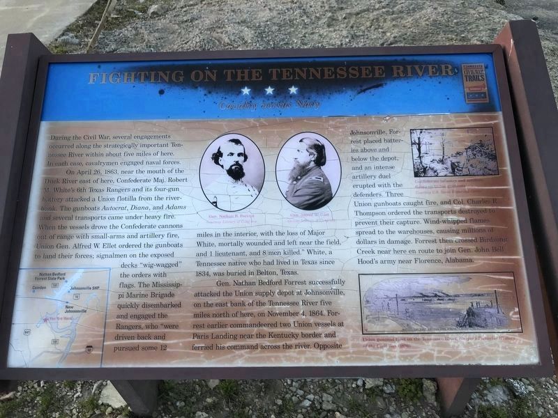
Fighting on the Tennessee River
Cavalry versus Navy
On April 26, 1863 near the mouth of the Duck River east of here, Confederate Maj. Robert M. White with the Texas Rangers and its four-gun battery attacked a Union flotilla from the river bank. The gunboats Autocrat, Diana, and Adams and several transports came under heavy fire. When the vessels drove the Confederate cannons out of range with small-arms and artillery fire, Union Gen. Alfred W. Ellet ordered the gunboats to land their forces, signalmen on the exposed decks “wig-wagged” the orders with flags. The Mississippi Marine Brigade quickly disembarked and engaged the Rangers, who “who were driven back and pursued some 12 miles in the interior, with the loss of Major White, mortally wounded and left near the field and 1 lieutenant and 8 men killed.” White, a Tennessee native who had lived in Texas since 1834, was buried in Belton, Texas.
Gen. Nathan Bedford Forrest successfully attacked the Union supply depot at Johnsonville on the east bank of the Tennessee River five miles north of here, on November 4, 1864. Forrest earlier commandeered two Union vessels at Paris Landing near the Kentucky border and ferried his command across the river. Opposite Johnsonville, Forrest placed batteries above and below the depot, and an intense artillery duel erupted with the defenders. Three Union gunboats caught fire, and Col. Charles R. Thompson ordered the transports destroyed to prevent their capture. Wind-shipped flames spread to the warehouses, causing millions of dollars in damage. Forrest then crossed Birdsong Creek near here en route to join Gen. John Bell Hood’s army near Florence, Alabama.
(captions)
(upper center) Gen. Nathan B. Forrest and Gen. Alfred W. Ellet Courtesy Library of Congress
(upper right) Confederate infantry and artillery firing on Union gunboats Courtesy U.S. Naval Historical Center
(lower right) Union gunboat fleet on the Tennessee River, Harper's Pictorial History of the Civil War (1896)
Erected by Tennessee Civil War Trails.
Topics and series. This historical marker is listed in these topic lists: War, US Civil • Waterways & Vessels. In addition, it is included in the Tennessee Civil War Trails series list. A significant historical month for this entry is April 1834.
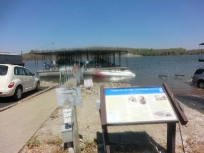
Location. 35° 58.232′ N, 88° 2.842′ W. Marker has been reported damaged. Marker is in Camden, Tennessee, in Benton County. Marker is on Birdsong Marina Road, half a mile east of Birdsong Road (Tennessee Route 191). Touch for map. Marker is at or near this postal address: 255 Marina Road, Camden TN 38320, United States of America. Touch for directions.
Other nearby markers. At least 8 other markers are within 7 miles of this location, measured as the crow flies. Thomas Clark Rye (approx. 6.7 miles away); Mary Cordelia Beasley-Hudson (approx. 6.7 miles away); David Benton (approx. 6.7 miles away); Senator Mildred Jolly Lashlee (approx. 6.7 miles away); Gunboats and Cavalry (approx. 6.7 miles away); Bombarding Johnsonville (approx. 6.7 miles away); Eva Archaic Site (approx. 6.8 miles away); Eva, A Community of the Western Banks of the Tennessee River (approx. 6.8 miles away). Touch for a list and map of all markers in Camden.
Credits. This page was last revised on March 9, 2020. It was originally submitted on June 17, 2014, by Don Morfe of Baltimore, Maryland. This page has been viewed 1,098 times since then and 27 times this year. Photos: 1. submitted on March 9, 2020, by Duane and Tracy Marsteller of Murfreesboro, Tennessee. 2, 3. submitted on June 17, 2014, by Don Morfe of Baltimore, Maryland. • Bernard Fisher was the editor who published this page.


