Near Field in Columbia-Shuswap, British Columbia — Canada’s West Coast (North America)
Kicking Horse Pass
Le Col du Cheval-Qui-Rue
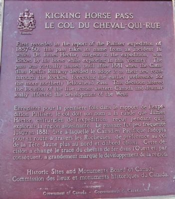
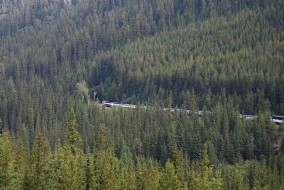
First recorded in the report of the Palliser expedition of 1857-60, this pass takes its name from an incident in which Dr. James Hector, surgeon in the expedition, was kicked by his horse while exploring in this vicinity. The pass was virtually unused until after 1881 when the Canadian Pacific Railway decided to adopt it as their new route through the Rockies, foregoing the earlier preference for the more northerly Yellowhead Pass. This decision altered the location of the line across western Canada and dramatically affected the development of the West.
Le Col du Cheval-Qui-Rue
Enregistré pour le première fois dans le rapport de l’expédition Palliser, le col doit son nom à la ruade que James Hector, chirurgien de l’expédition, reçut pendant qu’il explorait la région avoisinante. Le passage fut peu fréquenté jusqu’en 1881, date à laquelle le Canadien Pacifique l’adopta pour sa route à travers les Rocheuses, de preference au col de la Tête-Jaune plus au nord at d’abord choisi. Cette décision a change le trace du chemin de fers dans l’ouest et, par conséquent, a grandement marqué le développement de la région.
Erected 1980 by Historic Sites and Monuments Board of Canada.
Topics. This historical marker is listed in these topic lists: Exploration • Railroads & Streetcars. A significant historical year for this entry is 1881.
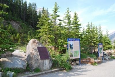
Location. 51° 27.209′ N, 116° 17.197′ W. Marker is near Field, British Columbia, in Columbia-Shuswap. Marker is on Transcanada Highway (National Route 1), on the right when traveling west. Located at the Spiral Tunnels Overlook in Yoho National Park just west of the Alberta-British Columbia boundary. Touch for map. Marker is in this post office area: Field BC V0A 1G0, Canada. Touch for directions.
Other nearby markers. At least 4 other markers are within 11 kilometers of this marker, measured as the crow flies. Chateau Lake Louise (approx. 6.3 kilometers away in Alberta); Parting of the Waters (approx. 7.5 kilometers away in Alberta); Lake Louise-Welcome (approx. 8.1 kilometers away in Alberta); Baldwin #7717 Steam Locomotive (approx. 10.3 kilometers away).
Credits. This page was last revised on August 22, 2017. It was originally submitted on July 4, 2008, by Dawn Bowen of Fredericksburg, Virginia. This page has been viewed 2,957 times since then and 22 times this year. Last updated on June 18, 2014, by Kevin Craft of Bedford, Quebec. Photos: 1, 2, 3, 4. submitted on July 4, 2008, by Dawn Bowen of Fredericksburg, Virginia. • Bill Pfingsten was the editor who published this page.


