Near Ehrhardt in Bamberg County, South Carolina — The American South (South Atlantic)
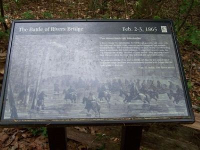
Battle of Rivers' Bridge
Feb. 2-3, 1865
Inscription.
"This Indescribably Ugly Salkehatchie "
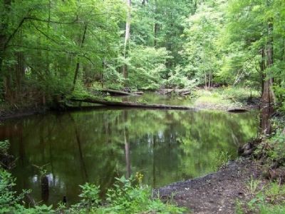
At Rivers Bridge the Salkehatchie flowed though a swamp a half mile wide. The only road through it was a narrow earthen causeway with multiple wooden bridges. The Confederates hoped the thick swamp and chest-deep water would hinder the Union advance. "a dog could scarcely make his way through the swamp" recalled a Union soldier. After the battle, Union Gen. Howard called the river " this indescribably Ugly Salkehatchie."
"So immense are the trees, and so thickly set, that the eye cannot reach half pistol range; and they are so abundantly covered with foliage that the light of day is shut out."
-Capt. F.Y. Hedley, 32nd Illinois Infantry
Erected by South Carolina State Park System.
Topics. This historical marker is listed in this topic list: War, US Civil.
Location. 33° 3.197′ N, 81° 6.09′ W. Marker is near Ehrhardt, South Carolina, in Bamberg County. Marker can be reached from SC-S-5-8, on the right when traveling south. Located in the Rivers Bridge State Park, a mile south of SC-S-5-31. Touch for map. Marker is in this post office area: Ehrhardt SC 29081, United States of America. Touch for directions.
Other nearby markers. At least 8 other markers are within walking distance of this marker. A different marker also named Battle of Rivers' Bridge (a few steps from this marker); a different marker also named Battle of Rivers' Bridge (within shouting distance of this marker); a different marker also named Battle of Rivers' Bridge (within shouting distance of this marker); a different marker also named Battle of Rivers' Bridge (about 400 feet away, measured in a direct line); a different marker also named Battle of Rivers' Bridge (about 500 feet away); a different marker also named Battle of Rivers' Bridge (about 600 feet away); a different marker also named Battle of Rivers' Bridge (about 600 feet away); a different marker also named Battle of Rivers' Bridge (about 700 feet away). Touch for a list and map of all markers in Ehrhardt.
More about this marker. Marker Background Pictures is from University of Michigan Digital Library Production Services.
Credits. This page was last revised on June 16, 2016. It was originally submitted on April 29, 2008, by Mike Stroud of Bluffton, South Carolina. This page has been viewed 1,404 times since then and 25 times this year. Photos: 1, 2, 3. submitted on April 29, 2008, by Mike Stroud of Bluffton, South Carolina. • Craig Swain was the editor who published this page.


