Marker Logo HMdb.org THE HISTORICAL
MARKER DATABASE
“Bite-Size Bits of Local, National, and Global History”
Cornish in Sullivan County, New Hampshire — The American Northeast (New England)
 

Cornish-Windsor Bridge


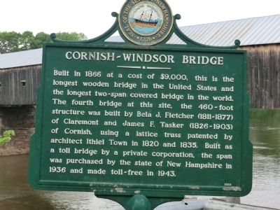
Cornish-Windsor Bridge Marker image. Click for full size.
Photographed By Don Morfe, May 23, 2013
1. Cornish-Windsor Bridge Marker
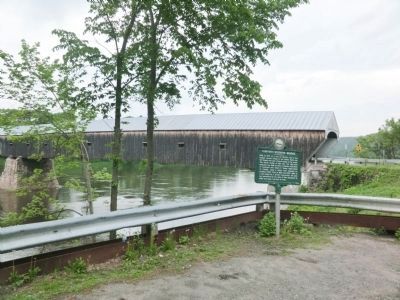
Inscription. Built in 1866 at a cost of $9,000, this is the longest wooden bridge in the United States and the longest two-span covered bridge in the world. The fourth bridge at this site, the 460-foot structure was built by Bela J. Fletcher (1811-1877) of Claremont and James F. Tasker (1826-1903) of Cornish, using a lattice truss patented by architect Ithiel Town in 1820 and 1835. Built as a toll bridge by a private corporation, the span was purchased by the state of New Hampshire in 1936 and made toll-free in 1943.
 
Erected by New Hampshire Division of Historical Resources. (Marker Number 158.)
 
Topics and series. This historical marker is listed in this topic list: Bridges & Viaducts. In addition, it is included in the ASCE Civil Engineering Landmarks, the Covered Bridges, and the New Hampshire Historical Highway Markers series lists. A significant historical year for this entry is 1866.
 
Location. 43° 28.383′ N, 72° 22.983′ W. Marker is in Cornish, New Hampshire, in Sullivan County. Marker is at the intersection of Chase Road (SR 12A) and Bridge Street on Chase Road (SR 12A). Touch for map. Marker is in this post office area: Cornish NH 03745, United States of America. Touch for directions.
 
Other nearby markers. At least 8 other markers are within walking distance of this marker. Lafayette's Tour (a few steps from this marker); Cornish-Windsor Covered Bridge (a few steps from
Paid Advertisement
Click on the ad for more information.
Please report objectionable advertising to the Editor.
Click or scan to see
this page online
this marker); Robbins and Lawrence Armory and Machine Shop (approx. 0.3 miles away in Vermont); Edwin A. Battison (approx. 0.3 miles away in Vermont); a different marker also named Robbins and Lawrence Armory and Machine Shop (approx. 0.3 miles away in Vermont); International Mechanical Engineering Heritage Collection (approx. 0.3 miles away in Vermont); American Precision Museum / Mill Brook & Waterpower (approx. 0.3 miles away in Vermont); a different marker also named Robbins and Lawrence Armory and Machine Shop (approx. 0.4 miles away in Vermont). Touch for a list and map of all markers in Cornish.
 
Cornish-Windsor Bridge Marker image. Click for full size.
Photographed By Don Morfe, May 23, 2013
2. Cornish-Windsor Bridge Marker
The Bridge is shown in the background
Cornish-Windsor Bridge Marker image. Click for full size.
Photographed By Don Morfe, May 23, 2013
3. Cornish-Windsor Bridge Marker
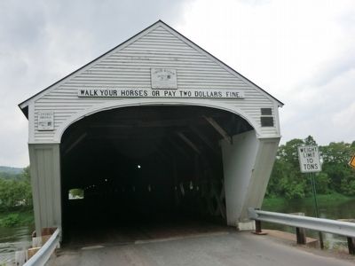
(Inscription above the entrance to the bridge) Walk your horses or pay two dollars fine
Cornish-Windsor Bridge Marker image. Click for full size.
Photographed By Don Morfe, May 23, 2013
4. Cornish-Windsor Bridge Marker
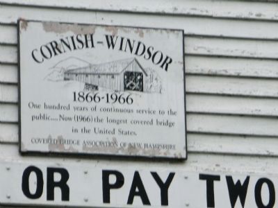
Sign above the entrance-Cornish-Windsor 1866-1966 One hundred years of continuous service to the public...Now (1966) the longest covered bridge in the United States. Covered Bridge Association of New Hampshire
Cornish-Windsor Bridge Marker image. Click for full size.
Photographed By Don Morfe, May 23, 2013
5. Cornish-Windsor Bridge Marker
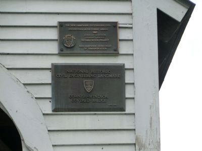
(Top Bronze plaque upper left side of entrance) The New Hampshire Outstanding Civil Engineering Achievement Award 1990-Cornish-Windsor Covered Bridge Rehabilitation Project. New Hampshire Department of Transportation. (Bottom Bronze plaque upper left side of entrance) National Historic Civil Engineering Landmark-American Society of Civil Engineers founded 1852-Cornish-Windsor Covered Bridge-ASCE 1970
Cornish-Windsor Bridge Marker image. Click for full size.
Photographed By Don Morfe, May 23, 2013
6. Cornish-Windsor Bridge Marker
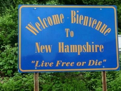
Welcome sign on the New Hampshire side of the Bridge
Cornish-Windsor Bridge Marker image. Click for full size.
Photographed By Don Morfe, May 23, 2013
7. Cornish-Windsor Bridge Marker
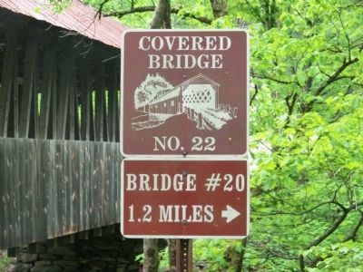
Covered Bridge #22 located on Town House Road, Cornish NH. GPS N43.4646 W72.3694. It is 1.2 miles from the Cornish-Windsor Covered Bridge, Bridge #20.
Cornish-Windsor Bridge Marker image. Click for full size.
Photographed By Don Morfe, May 23, 2013
8. Cornish-Windsor Bridge Marker
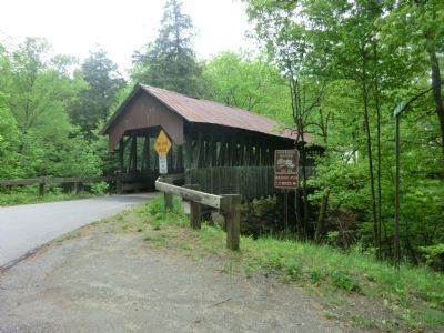
Distance shot of Covered Bridge #22
<i>Old Covered Bridge...</i> image. Click for full size.
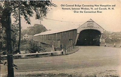
circa 1930
9. Old Covered Bridge...
Connecting New Hampshire and Vermont, Between Windsor, Vt. and Cornish, N.H. Over the Connecticut River
 
 
Credits. This page was last revised on July 26, 2017. It was originally submitted on June 9, 2013, by Don Morfe of Baltimore, Maryland. This page has been viewed 728 times since then and 46 times this year. Last updated on June 19, 2014, by Kevin Craft of Bedford, Quebec. Photos:   1, 2, 3, 4, 5, 6, 7, 8. submitted on June 9, 2013, by Don Morfe of Baltimore, Maryland.   9. submitted on September 23, 2015. • Bill Pfingsten was the editor who published this page.
Share this page.  
Share on Tumblr
m=74586

CeraNet Cloud Computing sponsors the Historical Marker Database.
This website earns income from purchases you make after using our links to Amazon.com. We appreciate your support.
Paid Advertisement
Apr. 19, 2024