Marker Logo HMdb.org THE HISTORICAL
MARKER DATABASE
“Bite-Size Bits of Local, National, and Global History”
Springdale in Washington County, Utah — The American Mountains (Southwest)
 

Discovery of Zion Canyon


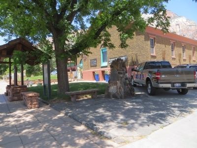
Discovery of Zion Canyon Marker image. Click for full size.
Photographed By Bill Kirchner, June 12, 2014
1. Discovery of Zion Canyon Marker
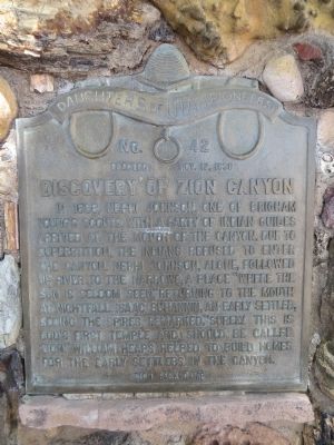
Inscription. In 1858, Nephi Johnson, one of Brigham Young's scouts, with a party of Indian guides arrived at the mouth of the canyon. Due to superstition, the Indians refused to enter the canyon. Nephi Johnson, alone, followed up river to the Narrows, a place "where the sun is seldom seen," returning to the mouth at nightfall. Isaac Buhannin, an early settler, seeing the spires remarked, "Surely this is God's first temple and should be called Zion." William Heaps helped to build homes for the early settlers in the canyon.
 
Erected 1938 by Zion Park Camp, Daughters of Utah Pioneers. (Marker Number 42.)
 
Topics and series. This historical marker is listed in these topic lists: ExplorationNatural Features. In addition, it is included in the Daughters of Utah Pioneers series list. A significant historical year for this entry is 1858.
 
Location. 37° 11.345′ N, 112° 59.893′ W. Marker is in Springdale, Utah, in Washington County. Marker is on Zion Park Boulevard, on the left when traveling east. Touch for map. Marker is at or near this postal address: 868 Zion Park Boulevard, Springdale UT 84767, United States of America. Touch for directions.
 
Other nearby markers. At least 8 other markers are within 7 miles of this marker, measured as the crow flies. Birth of a Park (approx. one mile away); Promised Land (approx. one mile away); Westward Expansion (approx.
Paid Advertisement
Click on the ad for more information.
Please report objectionable advertising to the Editor.
Click or scan to see
this page online
one mile away); Original Inhabitants / Living Traditions (approx. one mile away); Stephen Tyng Mather (approx. 1.7 miles away); Zion Mt. Carmel Tunnel and Highway, Utah (approx. 2.4 miles away); Rockville Bridge (approx. 3 miles away); Cables from the Rim (approx. 6˝ miles away). Touch for a list and map of all markers in Springdale.
 
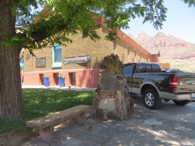
Discovery of Zion Canyon Marker image. Click for full size.
Photographed By Bill Kirchner, June 12, 2014
2. Discovery of Zion Canyon Marker
Discovery of Zion Canyon Marker image. Click for full size.
Photographed By Bill Kirchner, June 12, 2014
3. Discovery of Zion Canyon Marker
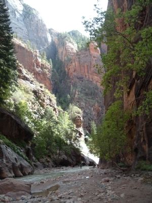
Zion Narrows image. Click for full size.
Photographed By Bill Kirchner, September 27, 2007
4. Zion Narrows
 
 
Credits. This page was last revised on June 16, 2016. It was originally submitted on June 20, 2014, by Bill Kirchner of Tucson, Arizona. This page has been viewed 757 times since then and 56 times this year. Photos:   1, 2, 3, 4. submitted on June 20, 2014, by Bill Kirchner of Tucson, Arizona. • Syd Whittle was the editor who published this page.
Share this page.  
Share on Tumblr
m=74630

CeraNet Cloud Computing sponsors the Historical Marker Database.
This website earns income from purchases you make after using our links to Amazon.com. We appreciate your support.
Paid Advertisement
Apr. 19, 2024