Dyersburg in Dyer County, Tennessee — The American South (East South Central)
Dyer County in the War
A Scoured Countryside
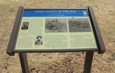
No major engagements took place in Dyer County, but foragers from both sides scoured the countryside here and in adjacent Gibson County. Confederate cavalry Col. William H. Jackson in 1862 described the area as “the richest portion of the State of Tennessee” with an “abundant supply of bacon, corn, and hay.” After a surprise attack on one of Jackson’s companies in August 1862, Union Gen. Grenville M. Dodge freed two slaves who had provided information.
Sharing borders with Kentucky, Missouri and Arkansas, Dyer County harbored several Confederate guerrilla bands. From his headquarters in Trenton, Dodge requested additional cavalry to fight them. By the end of the 1863, the pro-Union Memphis Bulletin reported that guerrilla activity had decreased.
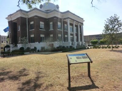
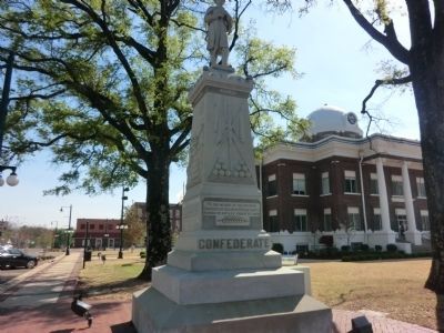
A confederate soldier, apparently acting alone, burned the courthouse in 1864. Rebuilt in 1867, it was replaced by the present Classical Revival building in 1911. Local resident Jane Skeffington unveiled the granite Confederate monument on the anniversary of the Battle of Shiloh in 1905.
(captions)
(upper left) Gen. Otho P. Stahl Tennessee Civil War National Heritage Area
(lower left) Gen. Grenville M. Dodge - Courtesy Library of Congress
(upper center) Foraging for hay - Courtesy Library of Congress
(upper right) Foragers on the prowl - Courtesy Library of Congress
Erected by Tennessee Civil War Trails.
Topics and series. This historical marker is listed in this topic list: War, US Civil. In addition, it is included in the Tennessee Civil War Trails series list. A significant historical year for this entry is 1864.
Location. 36° 1.957′ N, 89° 23.155′ W. Marker is in Dyersburg, Tennessee, in Dyer County. Marker is at the intersection of West Court Street and South Main Avenue, on the right when traveling east on West Court Street. The marker is located on the grounds of the Dyer County Courthouse. Touch for map. Marker is in this post office area: Dyersburg TN 38024, United States of America. Touch for directions.
Other nearby markers. At least 8 other markers are within walking distance of this marker. Dyer County Confederate Memorial (here, next to this marker); The Bank of Dyersburg (within shouting distance of this marker); Minglewood and “The Minglewood Blues” (within shouting distance of this marker); Dyer County Korean War Memorial (within shouting distance of this marker); Dyer County Walk of Fame (within shouting distance of this marker); Dyer County Vietnam War Memorial (within shouting distance of this marker); Dyer County WWII Memorial (within shouting distance of this marker); 1st Lt. James Alton Gardner (within shouting distance of this marker). Touch for a list and map of all markers in Dyersburg.
Credits. This page was last revised on June 16, 2016. It was originally submitted on June 20, 2014, by Don Morfe of Baltimore, Maryland. This page has been viewed 910 times since then and 41 times this year. Photos: 1, 2, 3. submitted on June 20, 2014, by Don Morfe of Baltimore, Maryland. • Bernard Fisher was the editor who published this page.


