Near Spotsylvania Courthouse in Spotsylvania County, Virginia — The American South (Mid-Atlantic)
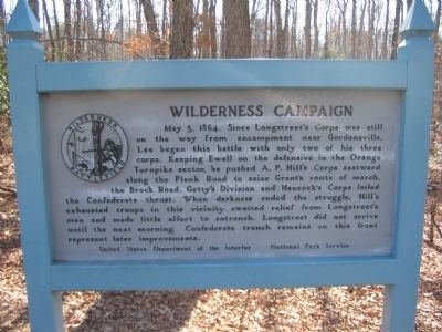
Wilderness Campaign
Erected by U.S. Department of the Interior - National Park Service.
Topics. This historical marker is listed in this topic list: War, US Civil. A significant historical date for this entry is May 5, 1977.
Location. 38° 17.658′ N, 77° 43.184′ W. Marker is near Spotsylvania Courthouse, Virginia, in Spotsylvania County. Marker is at the intersection of Hill Ewell Drive and Orange Plank Road (County Route 621), on the right when traveling south on Hill Ewell Drive. Touch for map. Marker is at or near this postal address: 11019 Orange Plank Rd, Spotsylvania VA 22551, United States of America. Touch for directions.
Other nearby markers. At least 8 other markers are within walking distance of this marker. James S. Wadsworth (about 500 feet away, measured in a direct line); Col. James D. Nance (approx. 0.2 miles away); Widow Tapp’s Field (approx. ¼ mile away); Crisis in Tapp Field (approx. ¼ mile away); Lee to the Rear! (approx. 0.3 miles away); Texas (approx. 0.3 miles away); Lee to the rear! (approx. 0.3 miles away); Brink of Victory (approx. 0.3 miles away). Touch for a list and map of all markers in Spotsylvania Courthouse.
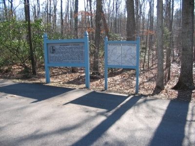
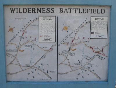
More about this marker. A map panel stands next to the marker, detailing the battle on May 5 and 6, 1864.
Also see . . . Wilderness Battlefield. National Park Service site. (Submitted on April 29, 2008, by Craig Swain of Leesburg, Virginia.)
Photographed By Craig Swain, February 16, 2008
2. Battle Map
Note the north seeking arrow on both maps points to the lower right.
Morning of May 5, 1864
Attempting to turn Lee, the Federals found themselves across his path. Crawford's Division of Warren's Corps was pulled back from its route to Parker's Store as Warren struck Ewell on the Turnpike. Here in the Plank Road sector, while Hill advanced toward the Brock, Getty's Division of Sedgwick's Corps rushed southward about midday to seize the vital Brock-Plank intersection.
Morning of May 6, 1864
On the Turnpike neither side gained advantage during the morning. Here on the Orange Plank Road, however, Hancock routed Hill, only to be stopped by Longstreet's timely arrival. Longstreet then flanked Hancock's forces back to the Brock Road. Both sides strongly entrenched on May 6 and 7.
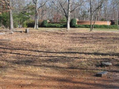
Photographed By Craig Swain, February 16, 2008
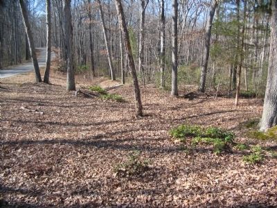
5. Shallow Trenches
The trenches near the intersection of the park tour road with the Orange Plank Road are somewhat shallower compared to those in other sectors. The brick wall in the background is the entrance to a housing subdivision on the south side of the Plank Road.
Credits. This page was last revised on July 9, 2021. It was originally submitted on April 29, 2008, by Craig Swain of Leesburg, Virginia. This page has been viewed 1,254 times since then and 12 times this year. Photos: 1, 2, 3, 4, 5. submitted on April 29, 2008, by Craig Swain of Leesburg, Virginia.
