Gloucester in Gloucester County, Virginia — The American South (Mid-Atlantic)
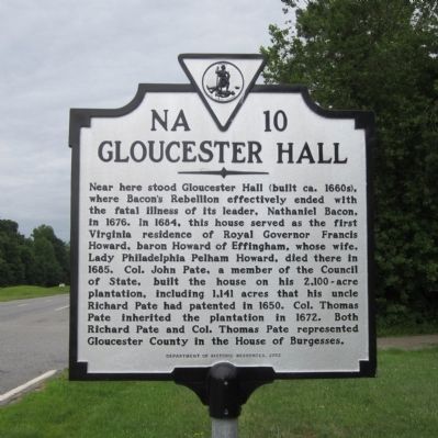
Gloucester Hall
Erected 2012 by Department of Historic Resources. (Marker Number NA-10.)
Topics and series. This historical marker is listed in these topic lists: Colonial Era • Government & Politics. In addition, it is included in the Virginia Department of Historic Resources (DHR) series list. A significant historical year for this entry is 1676.
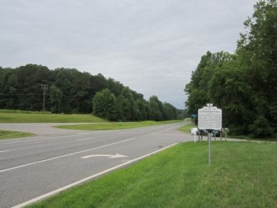
Location. 37° 29.001′ N, 76° 37.415′ W. Marker is in Gloucester, Virginia, in Gloucester County. Marker is at the intersection of George Washington Memorial Highway (U.S. 17) and Bacons Lane, on the right when traveling west on George Washington Memorial Highway . Touch for map. Marker is at or near this postal address: 11643 George Washington Memorial Hwy, Gloucester VA 23061, United States of America. Touch for directions.
Other nearby markers. At least 8 other markers are within 6 miles of this marker, measured as the crow flies. Poplar Spring Church (approx. 1.7 miles away); a different marker also named Poplar Spring Church (approx. 1.7 miles away); The Indentured Servants' Plot (approx. 2 miles away); King and Queen County / Gloucester County (approx. 2 miles away); Poropotank Creek (approx. 2 miles away); Marlfield (approx. 2.6 miles away); Bethel Baptist Church (approx. 5.1 miles away); a different marker also named King and Queen County / Gloucester County (approx. 5.6 miles away). Touch for a list and map of all markers in Gloucester.
Credits. This page was last revised on June 28, 2021. It was originally submitted on June 22, 2014, by Bernard Fisher of Richmond, Virginia. This page has been viewed 1,379 times since then and 115 times this year. Photos: 1, 2. submitted on June 22, 2014, by Bernard Fisher of Richmond, Virginia.

