Brighton in Tipton County, Tennessee — The American South (East South Central)
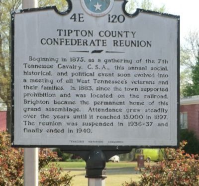
Tipton County Confederate Reunion
Erected by Tennessee Historical Commission. (Marker Number 4E 120.)
Topics and series. This historical marker is listed in this topic list: War, US Civil. In addition, it is included in the Tennessee Historical Commission series list. A significant historical year for this entry is 1875.
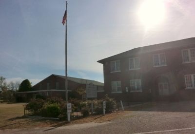
Location. 35° 28.901′ N, 89° 43.338′ W. Marker is in Brighton, Tennessee, in Tipton County. Marker is at the intersection of School Street and Church Street, on the left when traveling south on School Street. The marker is located on the grounds of the old Brighton High School. Touch for map. Marker is at or near this postal address: 66 School Street, Brighton TN 38011, United States of America. Touch for directions.
Other nearby markers. At least 8 other markers are within 7 miles of this marker, measured as the crow flies. Salem Associate Reformed Presbyterian Church (approx. 3.2 miles away); Clopton United Methodist Church (approx. 3.8 miles away); Mt. Carmel Presbyterian Church (approx. 4.3 miles away); Atoka Evangelical Presbyterian Church (approx. 4.4 miles away); Randolph (approx. 4.7 miles away); Mt. Zion — Munford (approx. 5.7 miles away); Munford United Methodist Church (approx. 5.7 miles away); Last Speech of General Nathan Bedford Forrest (approx. 6.2 miles away).
Credits. This page was last revised on January 20, 2020. It was originally submitted on June 23, 2014, by Don Morfe of Baltimore, Maryland. This page has been viewed 628 times since then and 28 times this year. Photos: 1, 2. submitted on June 23, 2014, by Don Morfe of Baltimore, Maryland. • Bernard Fisher was the editor who published this page.

