Niagara Falls in Niagara County, New York — The American Northeast (Mid-Atlantic)
Whirlpool Rapids
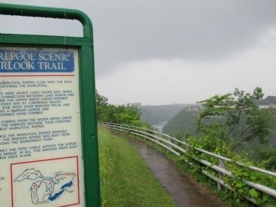
— Whirlpool Scenic Overlook Trail —
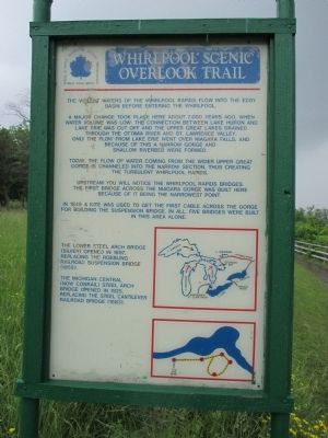
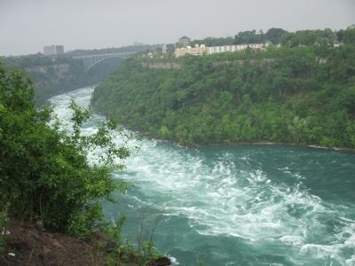
The violent waters of the Whirlpool Rapids flow into the Eddy Basin before entering the Whirlpool.
A major change took place here about 7,000 years ago, when water volume was low. The connection between Lake Huron and Lake Erie was cut off and the Upper Great Lakes drained through the Ottawa River and St. Lawrence Valley. Only the flow from Lake Erie went over Niagara Falls, and because of this a narrow gorge and shallow riverbed were formed.
Today, the flow of water coming from the wider Upper Great Gorge is channeled into the narrow section, thus creating the turbulent Whirlpool Rapids.
Upstream you will notice the Whirlpool Rapids Bridges. The first bridge across the Niagara Gorge was built here because of it being the narrowest point.
In 1848 a kite was used to get the first cable across the gorge for building the suspension bridge. In all, five bridges were built in this area alone.
The Lower Steel Arch Bridge (silver) opened in 1897, replacing the Roebling Railroad Suspension Bridge (1855).
The Michigan Central (now Conrail) Steel Arch Bridge opened in 1925, replacing the steel cantilever railroad bridge (1882).
Topics. This historical marker is listed in these topic lists: Bridges & Viaducts • Environment • Railroads & Streetcars • Waterways & Vessels. A significant historical year for this entry is 1848.
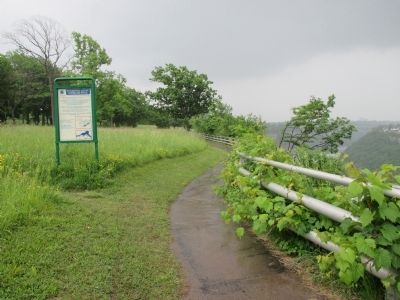
Location. 43° 7.162′ N, 79° 3.879′ W. Marker is in Niagara Falls, New York, in Niagara County. Marker can be reached from Robert Moses Parkway. Marker is located along the rim of the gorge in Whirlpool State Park, south of the tourist shelter. The park is accessed from the Niagara Scenic Parkway (nee: Robert Moses Parkway). Touch for map. Marker is in this post office area: Niagara Falls NY 14303, United States of America. Touch for directions.
Other nearby markers. At least 8 other markers are within walking distance of this marker. Eddy Basin (within shouting distance of this marker); Niagara Gorge Natural History (about 300 feet away, measured in a direct line); Welcome to Whirlpool State Park (about 300 feet away); Challenging the Whirlpool Rapids (about 300 feet away); Niagara Spanish Aero Car (approx. 0.2 miles away in Canada); Pastimes and Parkways (approx. 0.4 kilometers away); Whirlpool Rapids Gorge (approx. half a kilometer away in Canada); Thompson Point (approx. 0.6 kilometers away in Canada). Touch for a list and map of all markers in Niagara Falls.
Regarding Whirlpool Rapids. The text pertaining to the Michigan Central bridge is outdated. The bridge is closed. The Canadian Pacific Railway
(CP Rail) had owned the bridge. The City of Niagara Falls, Ontario purchased the right-of-way leading to the bridge from CP Rail in order to stop freight trains from traversing the dense tourist area near the falls. CP agreed to the sale after receiving trackage rights over the International Railway Bridge in Buffalo (Black Rock) controlled by The Canadian National Railway (CN).
The Whirlpool Rapids Bridge is sometimes known locally as the Lower Bridge, as in lower downriver (north) from the Rainbow Bridge, the prior bridge by the falls being known as the Upper Steel Arch (Honeymoon) Bridge. The Whirlpool Rapids Bridge is restricted to NEXUS trusted traveler members only, and is open from 0700 to 2300 hours daily. For NEXUS information see www.cbp.gov . The upper deck of the Whirlpool Rapids Bridge is rail recently purchased by Amtrak from CN. Amtrak trains 63/64 cross the bridge once a day in each direction between New York and Toronto.
For the history of the bridges north of the falls, see Seibel, George A., Bridges Over the Niagara Gorge, Niagara Falls Bridge Commission, 1991.
Also see . . . Whirlpool State Park. New York State Parks, Recreation and Historic Preservation website entry:
There is no fee for the park. (Submitted on June 25, 2014, by Anton Schwarzmueller of Wilson, New York.)
Credits. This page was last revised on January 4, 2022. It was originally submitted on June 25, 2014, by Anton Schwarzmueller of Wilson, New York. This page has been viewed 593 times since then and 75 times this year. Photos: 1, 2, 3, 4, 5. submitted on June 25, 2014, by Anton Schwarzmueller of Wilson, New York. • Bill Pfingsten was the editor who published this page.


