Near Clifton in Fairfax County, Virginia — The American South (Mid-Atlantic)
Wolf Run Shoals
Strategic Crossing Point
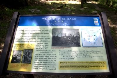
In December 1862, the Federal XI and XII Corps used the ford on their march from Northern Virginia south to Fredericksburg. In January 1863, the 2nd Vermont Brigade’s 12th and 13th Infantry camped on the north side of the ford. Because of increased Confederate partisan ranger activities under Captain John S. Mosby, the units were strengthened in March.
The Union Army of the Potomac’s II and VI Corps, as well as the Artillery Resere, crossed the shoals as they moved north in June 1863 towards Pennsylvania and Gettysburg. General Joseph Hooker, who then commanded the army, ordered the 2nd Vermont Brigade to follow, thereby leaving the ford unguarded. This action enabled Confederate General J.E.B. Stuart and his cavalrymen to cross here just 48 hours later, early in the morning of June 27, on what would become his controversial ride to Gettysburg.
Colonel John S. Mosby’s Rangers made the last reported military use of this ford in April 1865.
(sidebar) Local resident Mary Willcoxon nursed young Vermont Lieutenant Carmi Marsh back to health at her nearby house. The grateful Marsh provided her with financial support in her later years, including her funeral expenses.
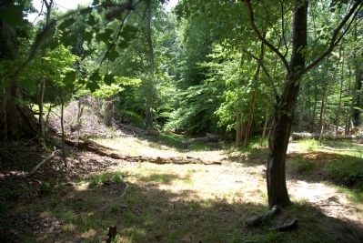
(sidebar) Wolf Run Shoals, a three-island ford that spans the Occoquan River here, has historic roots dating back to the Revolutionary War. In 1781, General George Washington ordered a road built for American and French wagons, cavalry, and cattle en route to Yorktown. Part of this road , now called the Washington-Rochembeau Wagon Route, lies directly in front of you and leads to the water’s edge. The shoal islands and the mill that once stood here, however, are now submerged in the Occoquan Reservoir.
Erected by Virginia Civil War Trails.
Topics and series. This historical marker is listed in these topic lists: War, US Civil • War, US Revolutionary. In addition, it is included in the Virginia Civil War Trails series list. A significant historical month for this entry is January 1863.
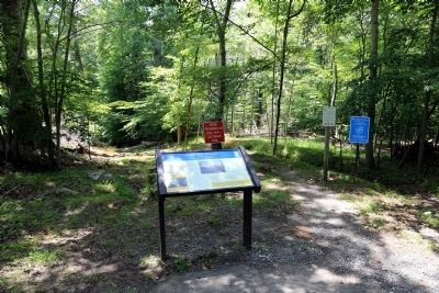
Location. 38° 43.678′ N, 77° 21.533′ W. Marker is near Clifton, Virginia, in Fairfax County. Marker is on Wolf Run Shoals Road (County Route 610) south of Henderson Road (County Route 643). Marker is at the end of the end of Wolf Run Shoals Road in Fairfax County. Touch for map. Marker is in this post office area: Clifton VA 20124, United States of America. Touch for directions.
Other nearby markers. At least 8 other markers are within 4 miles of this marker, measured as the crow flies. Washington-Rochambeau Wagon Route (approx. 0.8 miles away); This Is Fountainhead! (approx. 1.6 miles away); Enslaved Burial Ground at Bull Run Marina (approx. 1.7 miles away); Bacon Race Church and Cemetery (approx. 2½ miles away); Military Operations (approx. 2½ miles away); Bacon Race Church (approx. 2½ miles away); Oak Grove - Bacon Race Church (approx. 2½ miles away); World Trade Center Monument (approx. 3.4 miles away). Touch for a list and map of all markers in Clifton.
More about this marker. The marker has three photographs and a map. In the center is a photograph captioned “Co. A., 13th Vermont Infantry, at Wolf Run Shoals.” To the right of this photograph is a map by Brian McEnany and James Lewis showing the ford and the locations
of the 12th and 13th Vermont infantry and their guns. In the sidebar on the lower left are portraits of “Mary Willcoxon and her son, William” and “Lt. Carmi L. Marsh, 12th Vermont Infantry.”
Regarding Wolf Run Shoals. Wolf Run Shoal Road (the former Washington-Rochembeau Wagon Route) resumes on the Prince William County side of the reservoir. You can reach that section of the road from Davis Ford Road (PW County Route 663). Turn north onto Bacon Race Road (Route 610) and left on Wolf Run Shoals Road.
Additional commentary.
1. Caption on Picture 5.
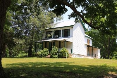
Regarding the caption on Picture 5. "Is this Mary Willcoxon’s House?" No, this is the Fairfax house. Buried about 100 yards up Wolf Run Shoals road on the right is the Fairfax-Buckley family cemetery. Buried there is Wellington Fairfax. He enlisted as a private at the age of 17
in Co. H, 15th Va Cavalry, then 43rd Battalion Cavalry of Mosby’s Rangers. This being his home ground, he would have been invaluable to Mosby in his raids of this area.
The Mary Wilcoxson house, where Lt. Marsh convalesced in January
and February 1863, is today located at 7700 Wolf Run Shoals Rd., Fairfax Station, VA 2203. It is known as Quailwood and is about 2 miles up Wolf Run Shoals Road by the intersection with Devereau Manor Lane. Note To Editor only visible by Contributor and editor
— Submitted March 5, 2018, by Mark Lazaroff of Clifton, Virginia.
Credits. This page was last revised on May 7, 2022. It was originally submitted on June 28, 2014, by J. J. Prats of Powell, Ohio. This page has been viewed 2,008 times since then and 216 times this year. Photos: 1, 2, 3, 4. submitted on June 28, 2014, by J. J. Prats of Powell, Ohio.


