Near Collinsville in Madison County, Illinois — The American Midwest (Great Lakes)
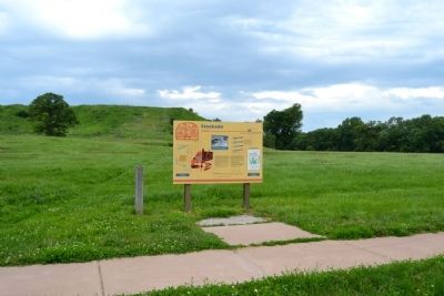
Stockade
A Walled City
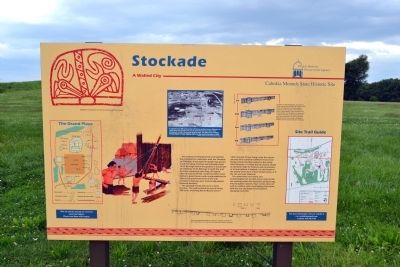
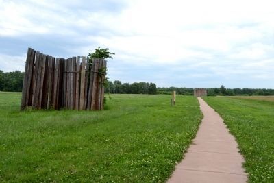
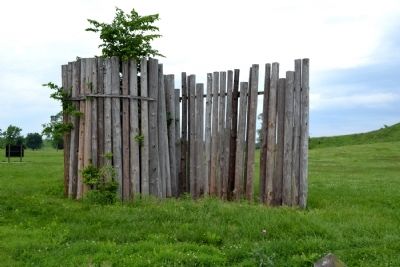
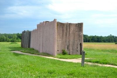
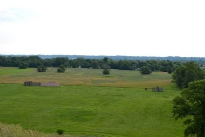
The central ceremonial precinct of Cahokia was enclosed by a defensive wall, the Stockade (or Palisade). It was built of upright logs placed in 4-5 foot deep trenches and probably stood 10-15 feet high above the ground. It would take an estimated 15-20,000 logs to build this wall that was nearly two miles long. At regular intervals (about 85 feet, center-to-center) were bastions, guard towers with raised platforms for warriors to protect the front of the wall. L-shaped entryways were occasionally placed between bastions.
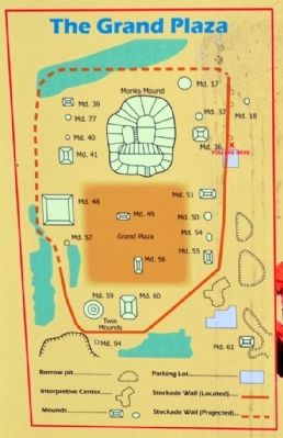
The Stockade would also serve a social function. The wall enclosed an area of nearly 200 acres, including Monks Mound and 17 other mounds. Those living inside the sacred precinct were somehow different from those living outside, possibly related to the ruling elite. However, it is likely that all citizens would be allowed inside for festivals and ceremonies, or to help defend, if needed. It is not known if the enemy were local or from distant areas, or if the site was ever attacked.
The wood does not survive, but archaeologists can see dark linear stains in the soil marking where the trenches had been dug into the lighter subsoils. Four constructions of wall are evident, often overlapping each other, with the size and shape of the bastions changing each time.
(Upper Left Illustration Caption)
Woodpecker head designs from the stone Ramey tablet from Cahokia
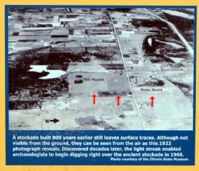
(Upper Center Image Caption)
A stockade built 800 years earlier still leaves surface traces. Although not visible from the ground, they can be seen from the air as this 1922 photograph reveals. Discovered decades later, the light streak enabled archaeologists to begin digging right over the ancient stockade in 1966.
Photo courtesy of the Illinois State Museum
(Lower Center Map Caption)
Map of the stockade excavations in this part of the site, showing the four constructions of the walls and their associated bastions and gates.
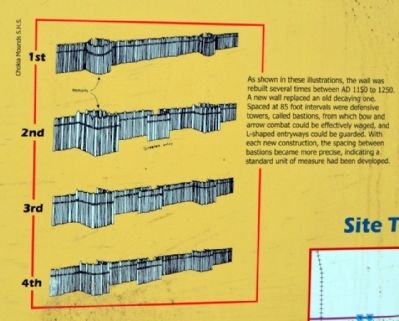
(Upper Right Illustration Caption)
As shown in these illustrations, the wall was rebuilt several times between AD 1150 to 1250. A new wall replaced an old decaying one. Spaced at 85 foot intervals were defensive towers, called bastions, from which bow and arrow combat could be effectively waged, and L-shaped entryways could be guarded. With each new construction, the spacing between bastions became more precise, indicating standard unit of measure had been developed.
Erected by Cahokia Mounds State Historic Site.
Topics. This historical marker is listed in these topic lists: Anthropology & Archaeology • Native Americans • Settlements & Settlers. A significant historical year for this entry is 1922.
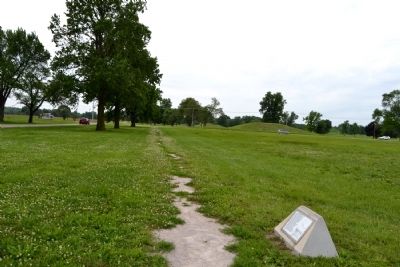
Location. 38° 39.632′ N, 90° 3.534′ W. Marker is near Collinsville, Illinois, in Madison County. Marker can be reached from Collins Lane, 0.1 miles north of Collinsville Road. Collins Lane ends in a parking lot for the trail to Monks Mound; marker is located north of the parking lot. Touch for map. Marker is in this post office area: Collinsville IL 62234, United States of America. Touch for directions.
Other nearby markers. At least 8 other markers are within walking distance of this marker. Cahokia (within shouting distance of this marker); The Stockade Path (about 300 feet away, measured in a direct line); Monks Mound - Southwest Corner (approx. 0.2 miles away); Mound 51 (approx. 0.2 miles away); Monks Mound (approx. 0.2 miles away); Monks Mound - 4th Terrace (approx. 0.2 miles away); Mound 50 (approx. 0.2 miles away); Monks Mound - South Ramp (approx. 0.2 miles away). Touch for a list and map of all markers in Collinsville.
Also see . . . Cahokia Mounds State Historic Site. Cahokia Mounds State Historic Site website homepage (Submitted on June 28, 2014.)
Credits. This page was last revised on June 24, 2022. It was originally submitted on June 28, 2014, by Duane Hall of Abilene, Texas. This page has been viewed 848 times since then and 72 times this year. Photos: 1, 2, 3, 4, 5, 6, 7, 8, 9, 10, 11. submitted on June 28, 2014, by Duane Hall of Abilene, Texas.
