East Hartford in Hartford County, Connecticut — The American Northeast (New England)
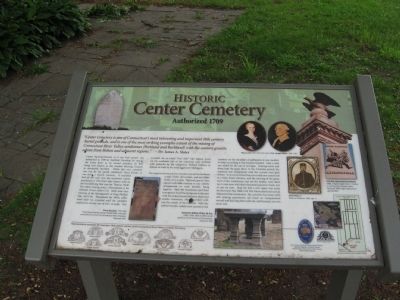
Historic Center Cemetery
Authorized 1709
Center Burying Ground, as it was first named, was authorized in 1709 by Hartford Township for east of the Great River as its second cemetery. Its first being now known as the Ancient Burying Ground in downtown Hartford. While this new cemetery was run by the parish, Hartford’s Third Parish, it was never a church cemetery. It consisted first of one acre, now the northwest corner, purchased in 1710 from John Pantry with its first burial being that year for Thomas Thrill. The oldest existing stone, a brownstone, is for Obadiah Wood (1648-1712). Both men were veterans of the Narragansett or King Phillip’s War (1675-76). Throughout the 1800s, additional land was acquired until he cemetery reached its current size of over 12 acres. This included the so-called “Fort Hill” (the highest point on the southeast side of the cemetery) once fortified with palisades by the indigenous Podunk Indians in defense of raids by the more aggressive Mohegans.
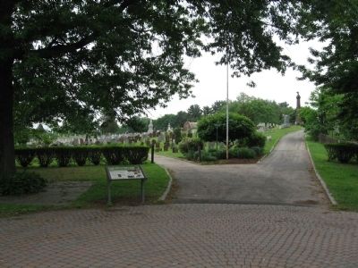
The original entrance to the cemetery was at the northeast corner of the old section, and not Main Street, as it is now. The early graves were placed with little concern to any orderly arrangement or even families being together. Here the headstones and their inscriptions faced the rising sun in the east with the caskets buried between them and smaller footstones, often inscribed with just the initials of the interred. With the earliest burials, caskets were carried on the shoulders of pallbearers in any number of relays according to the distance traveled. Later a road was added for the use of carriages. Grazing calves and sheep kept the grass short. In the Victorian period, the cemetery was reorganized with current road grid system. To accommodate these new roads now connected to a Main Street entrance, and the mowing of the grass, most of the tombstones, but not the bodies, were lined up in neat rows with their footstones placed in back, just as you see now. Atop the hill, a civic space was made for the town’s fine 1868 Civil War Monument and annual Memorial Day ceremonies. The cemetery has some 5,650 still exiting gravestones (all listed on computerized record) and has long been sold out, and funerals are ever more rare.
Erected 2009.
Topics. This historical marker is listed in these topic lists: Cemeteries & Burial Sites • Colonial Era. A significant historical year for this entry is 1709.
Location. 41° 46.212′ N, 72° 38.578′ W. Marker is in East Hartford, Connecticut, in Hartford County. Marker is at the intersection of Main Street and Phelps Place, on the right when traveling north on Main Street. Located just inside the entrance to Historic Center Cemetery. Touch for map. Marker is in this post office area: East Hartford CT 06108, United States of America. Touch for directions.
Other nearby markers. At least 8 other markers are within 2 miles of this marker, measured as the crow flies. East Hartford Civil War Monument (about 300 feet away, measured in a direct line); East Hartford World War I Monument (approx. 0.2 miles away); East Hartford (approx. 0.3 miles away); The Huguenot House (approx. one mile away); East Hartford World War II Monument (approx. one mile away); Union (approx. 1.2 miles away); Lincoln Meets Stowe (approx. 1.3 miles away); The Founders Bridge (approx. 1.3 miles away). Touch for a list and map of all markers in East Hartford.
Also see . . . Friends of Center Cemetery. (Submitted on June 29, 2014, by Michael Herrick of Southbury, Connecticut.)
Credits. This page was last revised on June 16, 2016. It was originally submitted on June 29, 2014, by Michael Herrick of Southbury, Connecticut. This page has been viewed 764 times since then and 58 times this year. Photos: 1, 2, 3. submitted on June 29, 2014, by Michael Herrick of Southbury, Connecticut.


