Pruntytown in Taylor County, West Virginia — The American South (Appalachia)
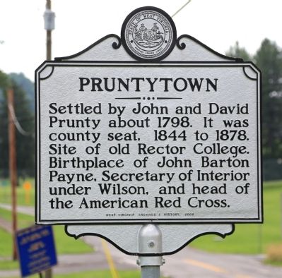
Pruntytown
Erected 2009 by West Virginia Archives and History.
Topics and series. This historical marker is listed in these topic lists: Political Subdivisions • Settlements & Settlers. In addition, it is included in the West Virginia Archives and History series list. A significant historical year for this entry is 1798.
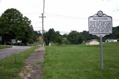
Location. 39° 20.01′ N, 80° 4.583′ W. Marker is in Pruntytown, West Virginia, in Taylor County. Marker is on Valley Falls Road (County Route 18) just south of U.S. 50, on the left when traveling south. Touch for map. Marker is in this post office area: Grafton WV 26354, United States of America. Touch for directions.
Other nearby markers. At least 8 other markers are within 3 miles of this marker, measured as the crow flies. First Taylor County Jail (a few steps from this marker); John Barton Payne (within shouting distance of this marker); Industrial School for Boys (about 400 feet away, measured in a direct line); Dedicated to the Memory of Thornsbury Bailey Brown (approx. 2.2 miles away); Valley Falls (approx. 2.4 miles away); Grave of Thornsbury Bailey Brown (approx. 2˝ miles away); Veterans Memorial (approx. 2˝ miles away); Grafton National Cemetery (approx. 2˝ miles away). Touch for a list and map of all markers in Pruntytown.
Credits. This page was last revised on June 16, 2016. It was originally submitted on June 29, 2014, by J. J. Prats of Powell, Ohio. This page has been viewed 544 times since then and 20 times this year. Photos: 1, 2. submitted on June 29, 2014, by J. J. Prats of Powell, Ohio.

