Millers Tavern in Essex County, Virginia — The American South (Mid-Atlantic)
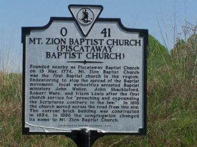
Mt. Zion Baptist Church
(Piscataway Baptist Church)
Erected 2003 by Department of Historic Resources. (Marker Number O-41.)
Topics and series. This historical marker is listed in these topic lists: Churches & Religion • Colonial Era. In addition, it is included in the Virginia Department of Historic Resources (DHR) series list. A significant historical date for this entry is March 13, 1774.
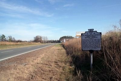
Location. 37° 49.748′ N, 76° 56.736′ W. Marker is in Millers Tavern, Virginia, in Essex County. Marker is on US 360, on the right when traveling east. Marker is east of the King & Queen County line. Touch for map. Marker is in this post office area: Millers Tavern VA 23115, United States of America. Touch for directions.
Other nearby markers. At least 8 other markers are within 6 miles of this marker, measured as the crow flies. Bacon's Northern Force (approx. ¼ mile away); Mattaponi Indian Town (approx. ¼ mile away); King and Queen County / Essex County (approx. ¼ mile away); Mount Pleasant (approx. 1.3 miles away); Bruington Church (approx. 4.4 miles away); Hillsboro (approx. 5.6 miles away); Apple Tree Church (approx. 5.9 miles away); Clark Home (approx. 6 miles away). Touch for a list and map of all markers in Millers Tavern.
Also see . . . On the Road in Essex County - O-41 Mt. Zion Baptist Church. 2020 article by Zorine Shirley in the River Country News.
Many believe that the name “Baptist” came from John the Baptist. Actually, it came from those who mocked these breakaways from Anglican domination, because of their belief in baptism by immersion in water. An unusually high number of Baptist ministers in the Colonies were arrested in pre-revolutionary America; however James Madison and Thomas Jefferson saw this in contrast to the freedom that the colonists were fighting for. In the First Amendment Madison wrote of the “free exercise of religion.” For over 200 years the Baptist faith has remained strong in Essex County and the country.(Submitted on September 17, 2020.)
Credits. This page was last revised on September 17, 2020. It was originally submitted on April 30, 2008, by Bill Pfingsten of Bel Air, Maryland. This page has been viewed 1,346 times since then and 37 times this year. Photos: 1. submitted on April 30, 2008, by Bill Pfingsten of Bel Air, Maryland. 2. submitted on December 8, 2009, by Bernard Fisher of Richmond, Virginia.

