Clarksburg in Carroll County, Tennessee — The American South (East South Central)
Clarksburg
Prelude, Battle of Parker's Crossroads
— Forrest's First West Tennessee Raid —
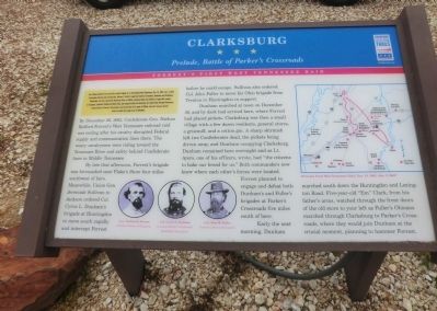
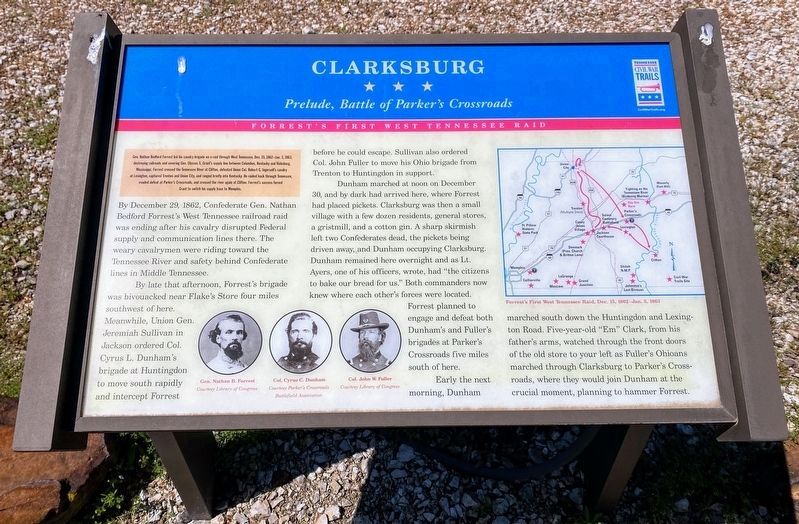
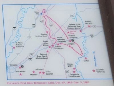
Gen. Nathan Bedford Forrest led his cavalry brigade on a raid through West Tennessee, Dec 15, 1862-Jan 3, 1863, destroying railroads and severing Gen. Ulysses S. Grant’s supply line between Columbus, Kentucky, and Vicksburg, Mississippi. Forrest crossed the Tennessee River at Clifton, defeated Union Col. Robert G. Ingersoll’s cavalry at Lexington, captured Trenton and Union City, and ranged briefly into Kentucky. He raided back through Tennessee, evaded defeat at Parker’s Cross Roads, and crossed the river again at Clifton. Forrest’s success forced Grant to switch his supply base to Memphis.
(main text)
By December 29, 1862, Confederate Gen. Nathan Bedford Forrest’s West Tennessee railroad raid was ending after his cavalry disrupted Federal supply and communication lines there. The weary cavalrymen were riding toward the Tennessee River and safety behind Confederate lines in Middle Tennessee.
By late that afternoon, Forrest’s brigade was bivouacked near Flake’s Store four miles southwest of here. Meanwhile, Union Gen. Jeremiah Sullivan in Jackson ordered Col. Cyrus L. Dunham’s brigade at Huntington to move south rapidly and intercept Forrest before he could escape. Sullivan also ordered Col. John Fuller to move his Ohio brigade from Trenton to Huntingdon in support.
Dunham marched at noon on December 30, and by dark had arrived here, where Forrest had placed pickets. Clarksburg was then a small village with a few dozen residents, general stores, a gristmill, and a cotton gin. A sharp skirmish left two Confederates dead, the pickets being driven away, and Dunham occupying Clarksburg. Dunham remained here overnight and as Lt. Ayers, one of his officers, wrote, had “the citizens to bake our bread for us.” Both commanders now knew where each other’s forces were located. Forrest planned to engage and defeat both Dunham’s and Fuller’s brigades at Parker’s Crossroads five miles south of here.
Early the next morning, Dunham marched south down the Huntingdon and Lexington Road. Five-year –old “Em” Clark, from his father’s arms, watched through the front doors of the old store to you left as Fuller’s Ohioans marched through Clarksburg to Parker’s Crossroads, where they would join Dunham at the crucial moment, planning to hammer Forrest.
(captions)
(lower left) Gen. Nathan B. Forrest Courtesy Library of Congress; Col. Cyrus C. Dunham Courtesy Parker’s Crossroads Battlefield Association; Col. John W. Fuller Courtesy Library of Congress
(upper right) Forrest's First West Tennessee Raid, Dec. 15, 1862-Jan. 3,1863
Erected by Tennessee Civil War Trails.
Topics and series. This historical marker is listed in this topic list: War, US Civil. In addition, it is included in the Tennessee Civil War Trails series list. A significant historical month for this entry is December 1840.
Location. 35° 52.22′ N, 88° 23.6′ W. Marker is in Clarksburg, Tennessee, in Carroll County. Marker is at the intersection of Lexington Clarksburg Road (Tennessee Route 22) and Tennessee Route 424 when traveling south on Lexington Clarksburg Road. Touch for map. Marker is in this post office area: Clarksburg TN 38324, United States of America. Touch for directions.
Other nearby markers. At least 8 other markers are within 5 miles of this marker, measured as the crow flies. Roan's Creek Church (approx. 1.8 miles away); The Battle of Parker's Crossroads (approx. 4.4 miles away); Pleasant Exchange (approx. 4.4 miles away); Parker's Crossroads City Park (approx. 5 miles away); Parker's Crossroads (approx. 5.1 miles away); a different marker also named The Battle of Parker's Crossroads (approx. 5.1 miles away); Freeman's Battery (approx. 5.1 miles away); a different marker also named The Battle of Parker's Crossroads (approx. 5.1 miles away).
More about this marker. As of April 2021, a Parrott Rifle no longer stands next to this marker.
Credits. This page was last revised on May 30, 2021. It was originally submitted on July 1, 2014, by Don Morfe of Baltimore, Maryland. This page has been viewed 1,255 times since then and 39 times this year. Last updated on May 29, 2021, by Shane Oliver of Richmond, Virginia. Photos: 1. submitted on July 1, 2014, by Don Morfe of Baltimore, Maryland. 2. submitted on May 28, 2021, by Shane Oliver of Richmond, Virginia. 3, 4. submitted on July 1, 2014, by Don Morfe of Baltimore, Maryland. • J. Makali Bruton was the editor who published this page.


