Gloucester in Gloucester County, Virginia — The American South (Mid-Atlantic)
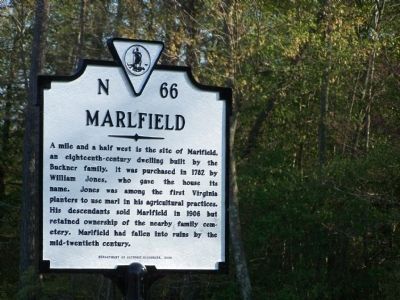
Marlfield
Erected 2008 by Department of Historic Resources. (Marker Number N-66.)
Topics and series. This historical marker is listed in these topic lists: Agriculture • Cemeteries & Burial Sites • Colonial Era • Notable Buildings. In addition, it is included in the Virginia Department of Historic Resources (DHR) series list. A significant historical year for this entry is 1782.
Location. 37° 27.131′ N, 76° 35.756′ W. Marker is in Gloucester, Virginia, in Gloucester County. Marker is on U.S. 17, 0.1 miles north of Enos Road (Route 613), on the right when traveling south. Touch for map. Marker is in this post office area: Gloucester VA 23061, United States of America. Touch for directions.
Other nearby markers. At least 8 other markers are within 5 miles of this marker, measured as the crow flies. Poplar Spring Church (approx. 0.9 miles away); a different marker also named Poplar Spring Church (approx. 0.9 miles away); Gloucester Hall (approx. 2.6 miles away); Bethel Baptist Church (approx. 3 miles away); Indian Princess Pocahontas (approx. 4.1 miles away); Cappahosic (approx. 4.1 miles away); Walter Reed Birthplace (approx. 4.4 miles away); Boutetourt #7 A.F. & A.M. Lodge (approx. 4.4 miles away). Touch for a list and map of all markers in Gloucester.
Also see . . . How is marl formed - Ask a Scientist. (Submitted on May 1, 2008, by Bill Pfingsten of Bel Air, Maryland.)
Credits. This page was last revised on June 16, 2016. It was originally submitted on May 1, 2008, by Bill Pfingsten of Bel Air, Maryland. This page has been viewed 1,887 times since then and 86 times this year. Photo 1. submitted on May 1, 2008, by Bill Pfingsten of Bel Air, Maryland.
