Mount Pleasant in Sanpete County, Utah — The American Mountains (Southwest)
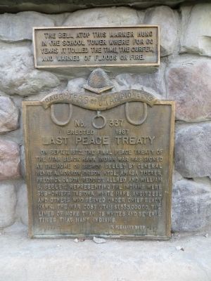
Last Peace Treaty
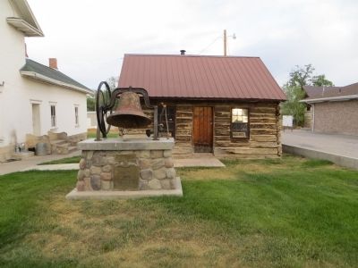
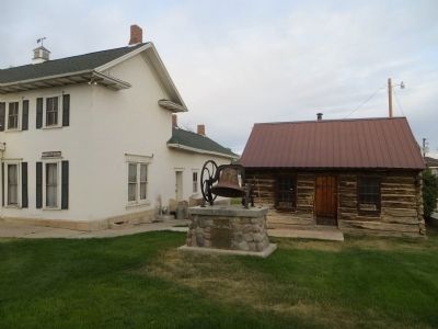
Upper Plaque The bell atop this marker hung in the school tower where for 60 years it tolled the time, the curfew, and warned of floods or fire.
Erected 1967 by Mt. Pleasant Camp, Daughters of Utah Pioneers. (Marker Number 337.)
Topics and series. This historical marker is listed in this topic list: Wars, US Indian. In addition, it is included in the Daughters of Utah Pioneers series list. A significant historical month for this entry is September 1854.
Location. 39° 32.683′ N, 111° 27.339′ W. Marker is in Mount Pleasant, Utah, in Sanpete County. Marker is on South State Street south of 100 South Street, on the right when traveling south. Touch for map. Marker is in this post office area: Mount Pleasant UT 84647, United States of America. Touch for directions.
Other nearby markers. At least 8 other markers are within 5 miles of this marker, measured as the crow flies. William Stuart Seeley House (a few steps from this marker); Pioneer Monument (about 700 feet away, measured in a direct line); The Liberal Hall (about 700 feet away); Mt. Pleasant Fort (approx. 0.2 miles away); Spring City Pioneer Cemetery (approx. 4.8 miles away); Behunin-Beck House (approx. 5 miles away); Spring City (approx. 5 miles away); City Hall (approx. 5 miles away). Touch for a list and map of all markers in Mount Pleasant.
Credits. This page was last revised on June 16, 2016. It was originally submitted on July 7, 2014, by Bill Kirchner of Tucson, Arizona. This page has been viewed 511 times since then and 15 times this year. Photos: 1, 2, 3. submitted on July 7, 2014, by Bill Kirchner of Tucson, Arizona. • Al Wolf was the editor who published this page.


