Near Mt. Storm in Grant County, West Virginia — The American South (Appalachia)
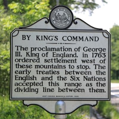
By King’s Command
Erected 2009 by West Virginia Archives and History.
Topics and series. This historical marker is listed in these topic lists: Colonial Era • Native Americans • Peace • Settlements & Settlers. In addition, it is included in the West Virginia Archives and History series list. A significant historical year for this entry is 1763.
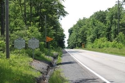
Location. 39° 16.705′ N, 79° 17.622′ W. Marker is near Mt. Storm, West Virginia, in Grant County. Marker is on George Washington Highway (U.S. 50) west of Cherry Ridge Road, on the left when traveling west. Touch for map. Marker is in this post office area: Mount Storm WV 26739, United States of America. Touch for directions.
Other nearby markers. At least 8 other markers are within 9 miles of this marker, measured as the crow flies. Fort Ogden (here, next to this marker); Honor Roll (approx. 2.8 miles away); In Honor (approx. 2.9 miles away); Grant County / State of Maryland (approx. 3 miles away); Site of Civil War Fort Pendleton (approx. 3.4 miles away in Maryland); Mineral County / Grant County (approx. 6.3 miles away); Highest Point on the Maryland State Roads System (approx. 6.7 miles away in Maryland); St. John's Evangelical Lutheran Church of Red House, Maryland (approx. 8.8 miles away in Maryland). Touch for a list and map of all markers in Mt. Storm.
More about this marker. The markers are easy to miss if you are traveling east.
Regarding By King’s Command. The boundary line was the Continental Divide, which runs along the Allegheny Mountains in this area. Lands where the waters flow to the Atlantic Ocean were British and lands where the waters flow towards the Mississippi were Indian.
Also see . . .
1. Royal Proclamation of 1763 - Wikipedia Entry. Excerpt: “The proclamation created a boundary line (often called the proclamation line) between the British colonies on the Atlantic coast and American Indian lands (called the Indian Reserve) west of the Appalachian Mountains. The proclamation line was not intended to be a permanent boundary between white and Aboriginal lands, but rather a temporary boundary which could be extended further west in an orderly, lawful manner. Its contour was defined by the headwaters that formed the watershed along the Appalachia—all land with rivers that flowed into the Atlantic was designated for the colonial entities while all the land with rivers that flowed into the Mississippi was reserved for the native Indian population. The proclamation outlawed private purchase of Native American land, which had often created problems in the past; instead, all future land purchases were to be made by Crown officials ‘at some public Meeting or Assembly of the said Indians.’ Furthermore, British colonists were forbidden to move beyond the line and settle on native lands, and colonial officials were forbidden to grant grounds or lands without royal approval. The proclamation gave the Crown a monopoly on all future land purchases from American Indians.” (Submitted on July 8, 2014.)
2. Iroquois, also known as the Haudenosaunee or the Six Nations. During the French and Indian War , the Iroquois sided with the British against the French and their Algonquian allies, both traditional enemies of the Iroquois. The Iroquois hoped that aiding the British would also bring favors after the war. . . . After the war, to protect their alliance, the British government issued the Royal Proclamation of 1763, forbidding white settlements beyond the Appalachian Mountains. Colonists largely ignored the order, and the British had insufficient soldiers to enforce it. The Iroquois agreed to adjust the line again at the Treaty of Fort Stanwix (1768), whereby they sold the British Crown all their remaining claim to the lands between the Ohio and Tennessee rivers.” (Submitted on July 8, 2014.)
Credits. This page was last revised on July 14, 2020. It was originally submitted on July 8, 2014, by J. J. Prats of Powell, Ohio. This page has been viewed 917 times since then and 41 times this year. Photos: 1, 2. submitted on July 8, 2014, by J. J. Prats of Powell, Ohio.

