Marker Logo HMdb.org THE HISTORICAL
MARKER DATABASE
“Bite-Size Bits of Local, National, and Global History”
Nephi in Juab County, Utah — The American Mountains (Southwest)
 

Salt Creek Fort


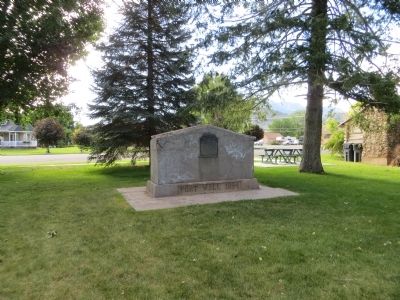
Salt Creek Fort Marker image. Click for full size.
Photographed By Bill Kirchner, June 15, 2014
1. Salt Creek Fort Marker
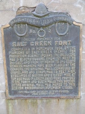
Inscription. Completed in November 1854 by the Pioneers of Salt Creek (Nephi) for protection against Indians. The inclosure was 3 blocks square, from 1st West to 2nd East and from 1st North to 2nd South Streets. Markers have been placed at the corners. The original wall, composed of gravel, mud and straw, was 12 feet high, 6 feet wide at bottom and 2 1/2 feet wide at top, 420 rods in length. Gates were provided in the north and the south walls. This section of the original wall was removed to this site for preservation, November 7, 1933.
 
Erected 1934 by Fort Wall Camp, Daughters of Utah Pioneers. (Marker Number 2.)
 
Topics and series. This historical marker is listed in this topic list: Forts and Castles. In addition, it is included in the Daughters of Utah Pioneers series list. A significant historical month for this entry is November 1854.
 
Location. 39° 42.974′ N, 111° 50.07′ W. Marker is in Nephi, Utah, in Juab County. Marker is on North 100 East Street north of East 500 North Street, on the left when traveling north. Marker is in city park. Touch for map. Marker is in this post office area: Nephi UT 84648, United States of America. Touch for directions.
 
Other nearby markers. At least 8 other markers are within 8 miles of this marker, measured as the crow flies. Early Schools (here, next to this marker); Juab Co. Jail (approx. 0.6 miles away); The Old Mill Wheel
Paid Advertisement
Click on the ad for more information.
Please report objectionable advertising to the Editor.
Click or scan to see
this page online
(approx. 0.6 miles away); Oscar M. Booth House (approx. 0.7 miles away); Burraston Ponds (approx. 5.6 miles away); Salt Creek Canyon Massacre (approx. 6.9 miles away); Mona Bicentennial Memorial Park (approx. 7 miles away); Old Pioneer Cemetery (approx. 7.4 miles away). Touch for a list and map of all markers in Nephi.
 
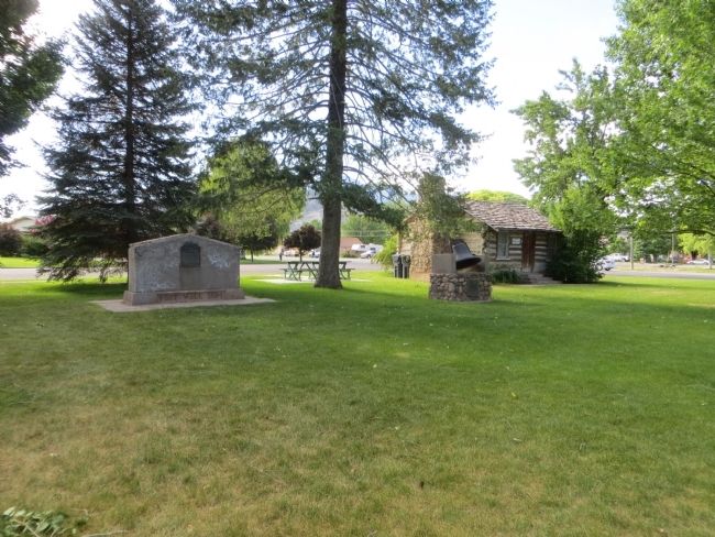
Salt Creek Fort Marker image. Click for full size.
Photographed By Bill Kirchner, June 15, 2014
2. Salt Creek Fort Marker
Salt Creek Fort Marker image. Click for full size.
Photographed By Bill Kirchner, June 15, 2014
3. Salt Creek Fort Marker
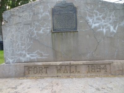
Salt Creek Fort Marker and Early Schools Marker image. Click for full size.
Photographed By Bill Kirchner, June 15, 2014
4. Salt Creek Fort Marker and Early Schools Marker
 
 
Credits. This page was last revised on June 16, 2016. It was originally submitted on July 11, 2014, by Bill Kirchner of Tucson, Arizona. This page has been viewed 836 times since then and 62 times this year. Photos:   1, 2, 3, 4. submitted on July 11, 2014, by Bill Kirchner of Tucson, Arizona. • Al Wolf was the editor who published this page.
Share this page.  
Share on Tumblr
m=75272

CeraNet Cloud Computing sponsors the Historical Marker Database.
This website earns income from purchases you make after using our links to Amazon.com. We appreciate your support.
Paid Advertisement
Apr. 18, 2024