Historic Bartlett in Shelby County, Tennessee — The American South (East South Central)
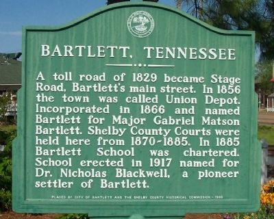
Bartlett, Tennessee
Erected 1980 by City of Bartlett and the Shelby County Historical Commission.
Topics. This historical marker is listed in these topic lists: Political Subdivisions • Roads & Vehicles • Settlements & Settlers. A significant historical year for this entry is 1829.
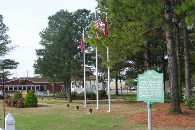
Location. 35° 12.24′ N, 89° 52.128′ W. Marker is in Bartlett, Tennessee, in Shelby County. It is in Historic Bartlett. Marker is at the intersection of Stage Road (Tennessee Route 15) and Bartlett Road, on the right when traveling east on Stage Road. Marker is located in Elva T. Bledsoe Historic Park. Touch for map. Marker is in this post office area: Memphis TN 38134, United States of America. Touch for directions.
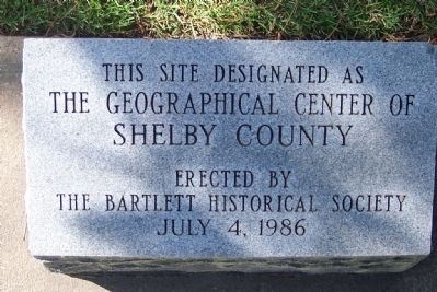
Other nearby markers. At least 8 other markers are within 3 miles of this marker, measured as the crow flies. The Geographical Center of Shelby County (within shouting distance of this marker); Nicholas Gotten (approx. ¼ mile away); Bartlett Veterans Memorial (approx. 0.3 miles away); Gabriel Maston Bartlett (approx. 1.1 miles away); St. Ann Catholic Church (approx. 1.3 miles away); Nashoba (approx. 2.2 miles away); The Lynching of Wash Henley (approx. 2.3 miles away); Oak Grove Baptist Church (approx. 2.8 miles away). Touch for a list and map of all markers in Bartlett.
Credits. This page was last revised on February 7, 2023. It was originally submitted on May 2, 2008, by Thomas S Parker of Memphis, Tennessee. This page has been viewed 1,802 times since then and 34 times this year. Photos: 1, 2, 3. submitted on May 2, 2008, by Thomas S Parker of Memphis, Tennessee. • Christopher Busta-Peck was the editor who published this page.


