Asheville in Buncombe County, North Carolina — The American South (South Atlantic)
Landsman Riley Powers
Mountain Sailor
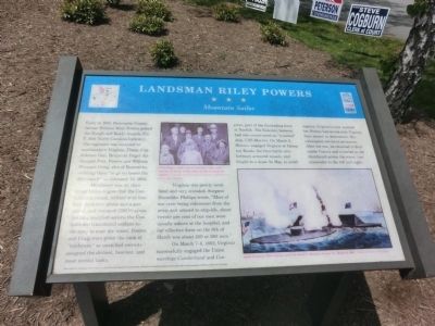
Merrimack was an abandoned Union frigate that the Confederates raised, refitted with four-inch iron plates and a gun turret, and renamed CSS Virginia. Lacking qualified sailors, the Confederates transferred soldiers to the navy to man the vessel. Powers and Craig were given the rank of “landsman” as unskilled recruits and assigned the dirtiest, heaviest, and most menial tasks.
Virginia was poorly ventilated and very crowded. Surgeon Dinwiddie Phillips wrote, “Most of our crew being volunteers from the army and unused to ship-life, about twenty per cent of our men were usually ashore at the hospital, and our effective force on the 8th of March was about 250 or 260 men.”
On March 7-8, 1862, Virginia successfully engaged the Union warships Cumberland and Congress, part of the blocking force at Norfolk. The Federals however had also constructed an “ironclad” ship, USS Monitor. On March 9, Monitor engaged Virginia at Hampton Roads, the first battle ever between armored vessels, and fought to a draw. In May, to avoid capture, Virginia’s crew scuttled her. Powers had served with Virginia from launch to destruction. His subsequent service is not known. After the war, he returned to Buncombe County and is buried in the churchyard across the street (use crosswalks to the left and right).
(captions)
(upper center) Riley Powers, back row, second from the right, with Zebulon B. Vance to his right, at 1890 Confederate reunion - Courtesy North Carolina Collection, Pack Memorial Library, Asheville
(lower right) Battle between CSS Virginia and USS Monitor, Hampton Roads, Va., March 8, 1862 - Courtesy Library of Congress
Erected by North Carolina Civil War Trails.
Topics and series. This historical marker is listed in these topic lists: Cemeteries & Burial Sites • War, US Civil • Waterways & Vessels. In addition, it is included in the North Carolina Civil War Trails series list. A significant historical date for this entry is February 18, 1862.
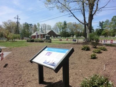
Location. 35° 29.294′ N, 82° 32.252′ W. Marker is in Asheville, North Carolina, in Buncombe County. Marker is on Overlook Road south of Springside Road (County Route 3506), on the left when traveling south. The marker is on the grounds of the Skyland/South Buncombe Library. Touch for map. Marker is at or near this postal address: 260 Overlook Road, Asheville NC 28803, United States of America. Touch for directions.
Other nearby markers. At least 8 other markers are within 4 miles of this marker, measured as the crow flies. French Broad River (approx. 3.2 miles away); Robert E. Lee (approx. 3.6 miles away); Frederick Law Olmsted (approx. 3.6 miles away); Edgar Wilson Nye (approx. 3.6 miles away); Calvary Church Episcopal (approx. 3.6 miles away); Shrub Garden (approx. 3.6 miles away); a different marker also named Edgar Wilson Nye (approx. 3.6 miles away); Calvary Episopal Church (approx. 3.6 miles away).
Credits. This page was last revised on June 16, 2016. It was originally submitted on July 21, 2014, by Don Morfe of Baltimore, Maryland. This page has been viewed 699 times since then and 26 times this year. Photos: 1, 2. submitted on July 21, 2014, by Don Morfe of Baltimore, Maryland. • Bernard Fisher was the editor who published this page.

