Asheville in Buncombe County, North Carolina — The American South (South Atlantic)
Battle of Asheville
Kirby's Expedition
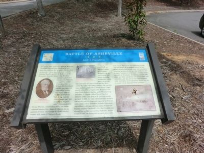
Clayton entrenched on Woodfin’s Ridge (now Lookout Mountain, up the trail to your left, where surviving earthworks can be seen), as well as east and north of Glen’s Creek and the Buncombe Turnpike (Broadway Avenue). He had 300 men, including Asheville’s “Silver Greys” home guard, a local fire company, two Napoleon cannons from Porters’s Battery, and 175 remaining members of Clayton’s 62nd North Carolina Infantry (after Gen. Robert E. Lee’s surrender on April 9, 1865, the men returned home without taking the oath of allegiance required by Federal authorities). Other defenders included convalescing soldiers, a 14-year-old boy, and a 70-year-old Baptist preacher. At about 3 p.m., the Confederates opened fire on the approaching Federals, and for several hours, the forces shot at each other with little result. The intense fire let Kirby to order “the withdrawal of the brigade at 8 p.m. In my opinion General Martin had under his immediate command at Asheville not less than 1000 men and six guns,” contrary to Greenwood’s estimate. Kirby retreated to Tennessee, abandoning cannons, bayonets, and other equipment. No one on either side was killed, and only two to four were wounded. After the battle the Confederates found “one leg in a boot” at the deserted Union position.
(captions)
(lower left) Nicholas Woodfin Courtesy North Carolina Collection, Pack Memorial Library, Asheville
(uper center) Reenactors on the confederate earthworks - Courtesy North Carolina Collection, Pack Memorial Library, Asheville
(lower right) Union cavalry attack a Confederate wagon train - Courtesy Library of Congress
Erected by North Carolina Civil War Trails.
Topics and series. This historical marker is listed in this topic list: War, US Civil. In addition, it is included in the North Carolina Civil War Trails series list. A significant historical month for this entry is April 1942.
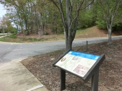
Location. 35° 36.919′ N, 82° 34.311′ W. Marker is in Asheville, North Carolina, in Buncombe County. Marker is at the intersection of Campus Drive and Field Drive, on the right when traveling north on Campus Drive. The marker is located on the grounds of the University of North Carolina Asheville. Touch for map. Marker is in this post office area: Asheville NC 28804, United States of America. Touch for directions.
Other nearby markers. At least 8 other markers are within one mile of this marker, measured as the crow flies. A different marker also named Battle of Asheville (approx. 0.2 miles away); Buncombe Turnpike (approx. 0.4 miles away); The University of North Carolina at Asheville (approx. 0.4 miles away); Zelda Fitzgerald (approx. 0.4 miles away); Richmond Pearson (approx. 0.6 miles away); Riverside Cemetery (approx. one mile away); a different marker also named Riverside Cemetery (approx. one mile away); a different marker also named Riverside Cemetery (approx. one mile away). Touch for a list and map of all markers in Asheville.
Credits. This page was last revised on November 10, 2022. It was originally submitted on July 21, 2014, by Don Morfe of Baltimore, Maryland. This page has been viewed 964 times since then and 64 times this year. Last updated on November 9, 2022, by Bradley Owen of Morgantown, West Virginia. Photos: 1, 2. submitted on July 21, 2014, by Don Morfe of Baltimore, Maryland. • Bernard Fisher was the editor who published this page.

