Waikiki in Honolulu County, Hawaii — Hawaiian Island Archipelago (Pacific Ocean)
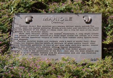
Mahiole
(Helmet)
Wars were frequent among the ancient Hawaiians. A king might attack the people of another island—or a chief might attack the village of a rival chief. Battles consisted largely of hand to hand combat using spears, clubs and daggers.
Feather covered capes and helmets were a mark of social rank. Only kings, the highest ranking chiefs, or warriors of great ability could wear these feathered garments. In time of war they were worn into battle. Lesser chiefs and warriors wore helmets without feather decorations.
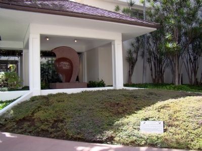
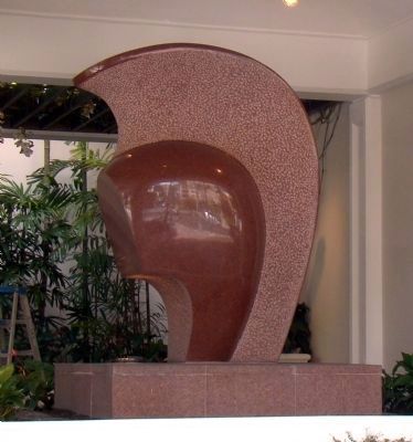
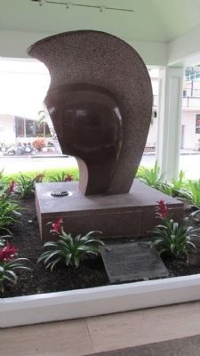
The high crested helmet shape sculptured from Indian granite and displayed here in the gatehouses of the Halekulani was the most elegant and elaborate of the ancient helmets and its possession and use was reserved exclusively for the kings of old Hawaii.
Erected 1983.
Topics. This historical marker is listed in this topic list: Military.
Location. 21° 16.717′ N, 157° 49.9′ W. Marker is in Waikiki, Hawaii, in Honolulu County. Marker is at the intersection of Kalia Road and Lewers Street, on the left when traveling north on Kalia Road. It is at the entrance to the Halekulani Hotel, on the right. Touch for map. Marker is at or near this postal address: 2199 Kalia Road, Honolulu HI 96815, United States of America. Touch for directions.
Other nearby markers. At least 8 other markers are within walking distance of this marker. Kawehewehe (about 600 feet away, measured in a direct line); Japanese Light Tank (about 700 feet away); U.S. 105mm Howitzer M3 (about 700 feet away); Japanese Type 1 (1941) (about 700 feet away); Afong Villa (about 700 feet away); Monarchy Cannon (about 700 feet away); U.S. Prefabricated Pill Box (about 700 feet away); U.S. Light Tank, M24 (about 700 feet away).
Credits. This page was last revised on February 10, 2023. It was originally submitted on November 2, 2008, by J. J. Prats of Powell, Ohio. This page has been viewed 2,041 times since then and 44 times this year. Last updated on July 23, 2014, by Mark Hilton of Montgomery, Alabama. Photos: 1, 2, 3. submitted on November 2, 2008, by J. J. Prats of Powell, Ohio. 4. submitted on April 25, 2014, by Denise Boose of Tehachapi, California. • Bill Pfingsten was the editor who published this page.


