Sonora in Tuolumne County, California — The American West (Pacific Coastal)
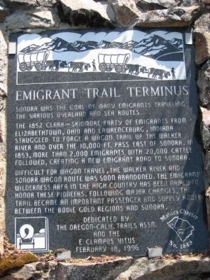
Emigrant Trail Terminus
The 1852 Clark-Skidmore Party of emigrants from Elizabethtown, Ohio and Lawrenceburg, Indiana struggled to force a wagon train up the Walker River and over the 10,000 ft. pass east of Sonora. In 1853, more than 2,000 emigrants with 20,000 cattle followed, creating a new emigrant road to Sonora.
Difficult for wagon travel, the Walker River and Sonora wagon route was soon abandoned. The Emigrant Wilderness area in the high country has been named to honor these pioneers. Following major changes, the trail became an important passenger and supply route between the Bodie gold regions and Sonora.
Erected 1996 by The Oregon-California Trails Association and E Clampus Vitus, Matuca Chapter No. 1849.
Topics and series. This historical marker is listed in these topic lists: Notable Events • Roads & Vehicles • Settlements & Settlers. In addition, it is included in the California Trail, and the E Clampus Vitus series lists. A significant historical year for this entry is 1852.
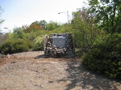
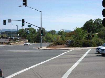
Location. 37° 58.489′ N, 120° 22.132′ W. Marker is in Sonora, California, in Tuolumne County. Marker is at the intersection of Mono Way (Old State Highway 108) and Greenley Road, on the right when traveling east on Mono Way (Old State Highway 108). Marker is on southwest corner of intersection. Abandoned State Highway Department office and yard is next door to the west. Touch for map. Marker is in this post office area: Sonora CA 95370, United States of America. Touch for directions.
Other nearby markers. At least 8 other markers are within walking distance of this marker. Jacob Richard Stoker (approx. 0.6 miles away); First Two-Story House in Sonora (approx. 0.9 miles away); Sonora (approx. 0.9 miles away); Sonora Opera Hall (approx. 0.9 miles away); Sonora Fountain (approx. 0.9 miles away); Sugg House (approx. 0.9 miles away); Sonora Inn (approx. 0.9 miles away); Site of the Sonora Plaza Well (approx. 0.9 miles away). Touch for a list and map of all markers in Sonora.
Credits. This page was last revised on June 16, 2016. It was originally submitted on May 3, 2008, by Richard Wisehart of Sonora, California. This page has been viewed 2,182 times since then and 34 times this year. Photos: 1, 2, 3. submitted on May 3, 2008, by Richard Wisehart of Sonora, California. • Christopher Busta-Peck was the editor who published this page.


