Near Spotsylvania Courthouse in Spotsylvania County, Virginia — The American South (Mid-Atlantic)
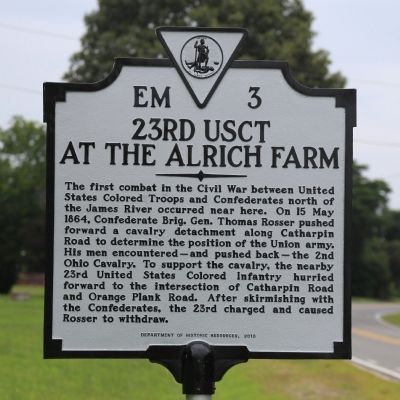
23rd USCT At the Alrich Farm
Erected 2013 by Department of Historic Resources. (Marker Number EM-3.)
Topics and series. This historical marker is listed in these topic lists: African Americans • War, US Civil. In addition, it is included in the Virginia Department of Historic Resources (DHR) series list. A significant historical date for this entry is May 15, 1864.
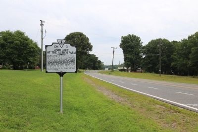
Location. 38° 16.948′ N, 77° 37.272′ W. Marker is near Spotsylvania Courthouse, Virginia, in Spotsylvania County. Marker is at the intersection of Catharpin Road (County Route 612) and Sawhill Boulevard (Local Route 2085), on the right when traveling south on Catharpin Road. It is just south of Old Plank Road. Touch for map. Marker is at or near this postal address: 11701 Sawhill Blvd, Spotsylvania VA 22553, United States of America. Touch for directions.
Other nearby markers. At least 8 other markers are within walking distance of this marker. The Wilderness and the Overland Campaign (approx. half a mile away); U. S. Colored Troops in Spotsylvania (approx. half a mile away); Sergeant Benjamin Brown (approx. half a mile away); Chancellorsville Campaign (approx. 0.9 miles away); a different marker also named Chancellorsville Campaign (approx. 0.9 miles away); Bivouac (approx. 0.9 miles away); Final Meeting, Fateful March (approx. 0.9 miles away); A Bold Plan (approx. 0.9 miles away). Touch for a list and map of all markers in Spotsylvania Courthouse.
More about this marker. Orange Plank Road mentioned on the marker is present-day Old Plank Road, County Route 610.
Also see . . . In Our Midst: First Combat of the USCTs in Northern Virginia. Narrative of the engagement at the Alrich Farm. With map. (Submitted on July 27, 2014, by J. J. Prats of Powell, Ohio.)
Credits. This page was last revised on July 9, 2021. It was originally submitted on July 27, 2014, by J. J. Prats of Powell, Ohio. This page has been viewed 889 times since then and 41 times this year. Photos: 1, 2. submitted on July 27, 2014, by J. J. Prats of Powell, Ohio. 3. submitted on May 24, 2016, by Kirk Heflin of Spotsylvania, Virginia.


