Sackets Harbor in Jefferson County, New York — The American Northeast (Mid-Atlantic)
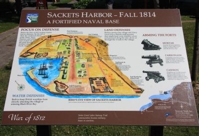
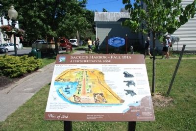
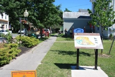
Sackets Harbor - Fall 1814
A Fortified Naval Base
— War of 1812 —
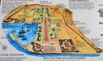
Before the War of 1812 Sackets Harbor had no defenses. By the fall of 1814, the combined efforts of the Army, Navy, Marines, and militia had created one of the most heavily fortified sites in North America.
Land Defenses
Built to protect the village and Navy Yard from a British raiding party that might land some distance away and proceed along the lake shore or through the woods to the village.
Arming the Forts
Mortar
A mortar fired an explosive shell at a steep angle to land inside an enemy's fort or onto the deck of a ship.
Carronade
Carronades were short-range weapons firing 12 to 68 pound solid iron balls, shotgun-like grape, or canister shot for use against enemy troops.
Cannon
Weighing up to 6,500 pounds, fortress cannon fired 9 to 32 pound solid iron balls to an effective range of about a mile. Cannon often fired balls heated red hot to set ships on fire.
Water Defenses
Built to keep British warships from directly attacking the village or entering Black River Bay.
Erected by Great Lakes Seaway Trail.
Topics and series. This historical marker is listed in these topic lists: Forts and Castles • War of 1812. In addition, it is included in the Great Lakes Seaway Trail National Scenic Byway series list. A significant historical year for this entry is 1812.
Location. 43° 56.824′ N, 76° 7.229′ W. Marker is in Sackets Harbor, New York, in Jefferson County. Marker is at the intersection of West Main Street (County Route 62) and Abrose Street, on the left when traveling west on West Main Street. This historical marker is located in the downtown business area, on the southeast corner of an intersection. Touch for map. Marker is in this post office area: Sackets Harbor NY 13685, United States of America. Touch for directions.
Other nearby markers. At least 8 other markers are within walking distance of this marker. Fort Virginia (about 500 feet away, measured in a direct line); Fort Chauncey (about 500 feet away); Blockhouse (about 600 feet away); Sackett Mansion (about 600 feet away); Dedicated to the Men and Women (about 600 feet away); Sackets Harbor (about 600 feet away); Sackets Harbor Shipbuilding (about 700 feet away); Union Hotel (approx. 0.2 miles away). Touch for a list and map of all markers in Sackets Harbor.
Credits. This page was last revised on June 16, 2016. It was originally submitted on July 30, 2014, by Dale K. Benington of Toledo, Ohio. This page has been viewed 554 times since then and 24 times this year. Photos: 1, 2, 3, 4, 5, 6. submitted on July 30, 2014, by Dale K. Benington of Toledo, Ohio.
