Woodsville in Easton in Grafton County, New Hampshire — The American Northeast (New England)
Wildwood
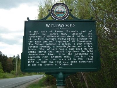
In this area of Easton (formerly part of Landaff and before that, Lincoln), the settlement of Wildwood once stood. At the turn of the 20th century Wildwood was a center for the "slash and run" logging of Mt. Moosilauke. The Village included a school, a post office, several sawmills, a boardinghouse and a few homes. West of here was a dam used in the spring drives that moved logs down the Wild Ammonoosuc River, from the mountains to southern New England mills. The last log drive on the river occurred in 1911. From 1933 to 1937, the first CCC camp authorized in NH was located at Wildwood.
Erected 2006 by New Hampshire Division of Historical Resources. (Marker Number 200.)
Topics and series. This historical marker is listed in these topic lists: Industry & Commerce • Settlements & Settlers. In addition, it is included in the New Hampshire Historical Highway Markers series list. A significant historical year for this entry is 1911.
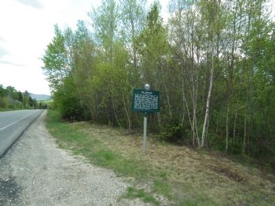
Location. 44° 5.529′ N, 71° 49.579′ W. Marker is in Easton, New Hampshire, in Grafton County. It is in Woodsville. Marker is at the intersection of E. Lost River Road (New Hampshire Route 112) and Tunnel Brook Road, on the right when traveling east on E. Lost River Road. Touch for map. Marker is in this post office area: Woodsville NH 03785, United States of America. Touch for directions.
Other nearby markers. At least 8 other markers are within 8 miles of this marker, measured as the crow flies. The Night the Bomber Crashed (approx. 4 miles away); Betty and Barney Hill Incident (approx. 7.1 miles away); Franconia Range (approx. 7.2 miles away); A Bit of History (approx. 7.2 miles away); Franconia Notch State Park (approx. 7.3 miles away); Eastern Brook Trout (approx. 7.3 miles away); The Flume (approx. 7.3 miles away); a different marker also named The Flume (approx. 7.3 miles away).
Credits. This page was last revised on February 16, 2023. It was originally submitted on July 30, 2014, by Kevin Craft of Bedford, Quebec. This page has been viewed 597 times since then and 41 times this year. Photos: 1, 2. submitted on July 30, 2014, by Kevin Craft of Bedford, Quebec. • Bill Pfingsten was the editor who published this page.

