Sackets Harbor in Jefferson County, New York — The American Northeast (Mid-Atlantic)
The Landing Area
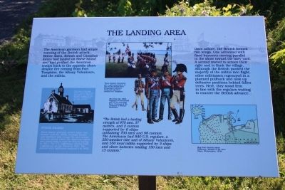
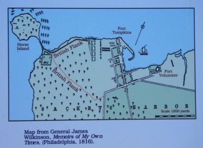
Once ashore, the British formed two wings. One advanced with fixed bayonets moving parallel to the shore toward the navy yard. A second moved to screen their right and to flank the village. Although the British pushed the majority of the militia into flight, other militiamen regrouped in a planned pullback and took up defensive positions behind fallen trees. Here, they stood firm in line with the regulars waiting to counter the British advance.
"The British had a landing strength of 870 men, 37 natives, and 2 cannon supported by 6 ships containing 700 men and 98 cannon. The Americans had 840 U.S. regulars, a 250-member elite unit of Albany Volunteers, and 550 local militia supported by 3 ships and shore batteries totaling 150 men and 13 cannon."
Horse Island
Horse Island, privately owned today, was farmed until the 1930s. Summer homes and farmland now occupy the area across from the island, where the American militia once stood ready to repel the British landing in 1813. The U.S. Lighthouse Service built a lighthouse on the island in 1831. The present brick lighthouse replaced it in 1870.
Erected by the State of New York. (Marker Number 3.)
Topics and series. This historical marker is listed in this topic list: War of 1812. In addition, it is included in the Lighthouses series list. A significant historical year for this entry is 1813.
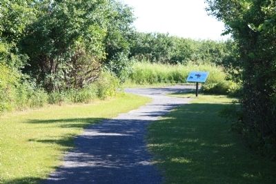
Location. 43° 56.774′ N, 76° 7.794′ W. Marker is in Sackets Harbor, New York, in Jefferson County. Marker can be reached from Washington Street east of Ontario Street. This historical marker is located in Sackets Harbor Battlefield State Park, along the walking path that leads from the battlefield to the site of Fort Kentucky where the British assault on the defenses of Sackets Harbor began. Touch for map. Marker is in this post office area: Sackets Harbor NY 13685, United States of America. Touch for directions.
Other nearby markers. At least 8 other markers are within walking distance of this marker. The British Observation Point (within shouting distance of this marker); British Attack on Sackets Harbor (about 400 feet away, measured in a direct line); Smoothbore Muzzle Loader Cannon (about 500 feet away); Fort Kentucky (about 500 feet away); The British Advance is Halted (about 600 feet away); American Dragoon Commander Wounded (approx. ¼ mile away); a different marker also named Smoothbore Muzzle Loader Cannon
(approx. ¼ mile away); Welcome to Sackets Harbor Battlefield (approx. 0.3 miles away). Touch for a list and map of all markers in Sackets Harbor.
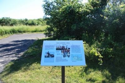
More about this marker. This historical marker is located at the extreme southwestern end of the Battlefield Park's walking path, where the path loops around what had been the site of Fort Kentucky.
Also see . . . Sackets Harbor Battlefield - National Archives. National Register of Historic Places documentation (Submitted on February 25, 2024, by Anton Schwarzmueller of Wilson, New York.)
Credits. This page was last revised on February 25, 2024. It was originally submitted on August 2, 2014, by Dale K. Benington of Toledo, Ohio. This page has been viewed 388 times since then and 17 times this year. Last updated on August 19, 2021, by Robert Rusaw of Massena, New York. Photos: 1, 2, 3, 4, 5, 6. submitted on August 2, 2014, by Dale K. Benington of Toledo, Ohio. • Bill Pfingsten was the editor who published this page.
