Fultonville in Montgomery County, New York — The American Northeast (Mid-Atlantic)
Mohawk Area
Historic New York
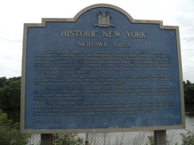
The Mohawk Valley was a principal pass to the interior between the Adirondack Mountains and the Allegheny Plateau. Here dwelt the Mohawks, one of the Nations of the Iroquois Confederacy who barred the white man's advance westward. In the seventeenth century they were visited by French Catholic missionaries from Canada, some of whom suffered martyrdom. In 1712, with the aid of Queen Anne, an Anglican Chapel for the Mohawks was erected at Fort Hunter.
Trade goods and furs were carried by river boats over the Mohawk between Albany and the West. The same route was followed by military expeditions during the French and Indian War.
From Fort Johnson, and after 1763 from Johnson Hall at Johnstown, Sir William Johnson ably conducted Indian affairs for the British government. During the Revolution, Tory and Indian raiders from Canada harassed the Mohawk Valley settlements.
The completion of the Erie Canal in 1825 and the formation of the New York Central Railroad in 1853 introduced an era of rapid settlement and industrial growth. In the twentieth century improved highways follow this historic route, long famed for its scenic beauty.
Erected 1965 by New York State Education Department.
Topics and series. This historical marker is listed in these topic lists: Colonial Era • Native Americans • Settlements & Settlers • War, French and Indian. In addition, it is included in the Historic New York State series list. A significant historical year for this entry is 1712.
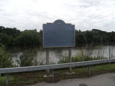
Location. 42° 56.599′ N, 74° 23.825′ W. Marker is in Fultonville, New York, in Montgomery County. Marker is on NY Thruway (U.S. I-90), on the right when traveling west. Marker is at a rest area on the New York Thruway. Touch for map. Marker is in this post office area: Auriesville NY 12016, United States of America. Touch for directions.
Other nearby markers. At least 8 other markers are within walking distance of this marker. Herkimer Home - 1764 (within shouting distance of this marker); Site of The Battle of Oriskany (about 400 feet away, measured in a direct line); Johnson Hall - 1763 (approx. 0.2 miles away); a different marker also named Mohawk Area (approx. 0.2 miles away); Veeder Home (approx. 0.3 miles away); Kateri's Home (approx. half a mile away); A Liberty Pole (approx. half a mile away); Volkert Veeder (approx. half a mile away). Touch for a list and map of all markers in Fultonville.
Credits. This page was last revised on June 16, 2016. It was originally submitted on August 4, 2014, by Bill Coughlin of Woodland Park, New Jersey. This page has been viewed 449 times since then and 11 times this year. Photos: 1, 2, 3. submitted on August 4, 2014, by Bill Coughlin of Woodland Park, New Jersey.


