Parole in Annapolis in Anne Arundel County, Maryland — The American Northeast (Mid-Atlantic)
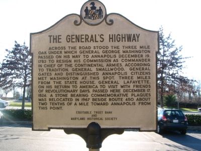
The Generalís Highway
Erected by Equitable Trust Bank and Maryland Historical Society.
Topics and series. This historical marker is listed in these topic lists: Colonial Era • Government & Politics • Patriots & Patriotism. In addition, it is included in the Lafayetteís Farewell Tour series list. A significant historical date for this entry is December 19, 1783.
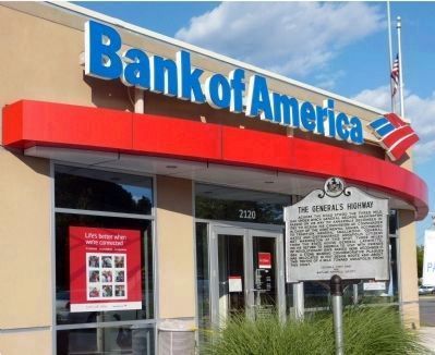
Location. 38° 59.171′ N, 76° 32.859′ W. Marker is in Annapolis, Maryland, in Anne Arundel County. It is in Parole. Marker is at the intersection of Generals Highway (Maryland Route 178) and Defense Highway (Maryland Route 450), on the left when traveling south on Generals Highway. Touch for map. Marker is at or near this postal address: 2120 West Street, Annapolis MD 21401, United States of America. Touch for directions.
Other nearby markers. At least 8 other markers are within 2 miles of this marker, measured as the crow flies. Trunk of the Three Mile Oak (approx. 0.2 miles away); Camp Parole (approx. 0.7 miles away); Political Representation in Ward Three, Parole (approx. one mile away); You Are Here (approx. one mile away); Mount Olive African Methodist Episcopal Church (approx. one mile away); Annapolis Water Company (approx. one mile away); Cecil Memorial United Methodist Church (approx. 1.1 miles away); Parole Health Center (approx. 1.2 miles away). Touch for a list and map of all markers in Annapolis.

Photographed By F. Robby, December 30, 2003
2. Trunk of the Three Mile Oak
The bottom marker is the original moved here in 1967. The top marker was added at the same time. They read:
(top)This oak tree planted in 1967 perpetuates the memory of the original Three Mile Oak which stood nearby as explained in the marker below.
Erected in 1967 by the Four Rivers Garden Club
(bottom)
Trunk of the Three Mile Oak
Under this tree passed General George Washington December 19, 1783 on his way to Annapolis to resign his commission as Commander-in-Chief of the Continental Armies; and it is thought that General Smallwood accompanied by General Gates and distinguished citizens of Annapolis met General Washington on this spot.
General Lafayette passed here December 17, 1824 to visit the Friends of Revolutionary Days.
Erected by the Rotary Club of Annapolis.
(top)
Erected in 1967 by the Four Rivers Garden Club
(bottom)
General Lafayette passed here December 17, 1824 to visit the Friends of Revolutionary Days.
Erected by the Rotary Club of Annapolis.
Credits. This page was last revised on July 20, 2020. It was originally submitted on October 9, 2007, by F. Robby of Baltimore, Maryland. This page has been viewed 4,085 times since then and 99 times this year. Last updated on August 6, 2014, by Mark Hilton of Montgomery, Alabama. Photos: 1, 2. submitted on October 9, 2007, by F. Robby of Baltimore, Maryland. 3. submitted on November 6, 2013, by Allen C. Browne of Silver Spring, Maryland. • Bill Pfingsten was the editor who published this page.

