Eau Claire in Eau Claire County, Wisconsin — The American Midwest (Great Lakes)
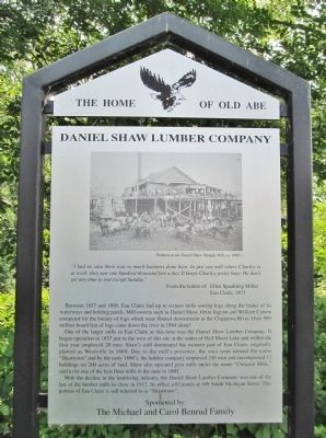
Daniel Shaw Lumber Company
"I had no idea there was so much business done here. In just one mill where Charley is at work, they saw one hundred thousand feet a day. It keeps Charley pretty busy. He don't get any time to rest except Sunday."
Eau Claire, 1873
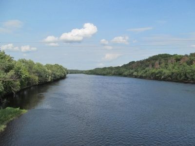
Between 1857 and 1890, Eau Claire had up to sixteen mills sawing logs along the banks of its waterways and holding ponds. Mill owners such as Daniel Shaw, Orrin Ingram and William Carson competed for the bounty of logs which were floated downstream in the Chippewa River. Over 989 million board feet of logs came down the river in 1884 alone!
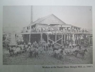
One of the larger mills in Eau Claire at this time was the Daniel Shaw Lumber Company. It began operation in 1857 just to the west of this site at the outlet of Half Moon Lake and within the first year employed 20 men. Shaw's mill dominated the western part of Eau Claire, originally platted as Westville in 1869. Due to the mill's presence, the area soon earned the name "Shawtown" and by the early 1890's, the lumber company employed 249 men and encompassed 12 buildings on 200 acres of land. Shaw also operated grist mills under the name "Crescent Mills," said to be one of the best flour mills in the state in 1880.
With the decline in the lumbering industry, the Daniel Shaw Lumber Company was one of the last of the lumber mills to close in 1912. Its office still stands at 109 South Michigan Street. This portion of Eau Claire is still referred to as "Shawtown".
The Michael and Carol Benrud Family
Erected by the City of Eau Claire Landmark Commission; the Michael and Carol Benrud Family. (Marker Number 2.)
Topics. This historical marker is listed in these topic lists: Industry & Commerce • Waterways & Vessels. A significant historical year for this entry is 1873.
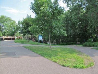
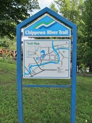
Location. 44° 47.89′ N, 91° 31.571′ W. Marker is in Eau Claire, Wisconsin, in Eau Claire County. Marker can be reached from Menomonie Street south of Carson Park Drive, on the right when traveling east. Marker is at the junction of the Lakeshore Trail and the Chippewa River Trail. Touch for map. Marker is in this post office area: Eau Claire WI 54703, United States of America. Touch for directions.
Other nearby markers. At least 8 other markers are within walking distance of this marker. Early Exploration and Settlement (about 700 feet away, measured in a direct line); The River Did Its Part (approx. 0.4 miles away); Kaiser Lumber Company Office (approx. 0.4 miles away); Carson Park (approx. 0.6 miles away); Industry on Half Moon Lake
(approx. 0.6 miles away); 2719 (approx. 0.6 miles away); Henry Aaron / Eau Claire Baseball (approx. 0.7 miles away); Carson Park Baseball Stadium (approx. 0.7 miles away). Touch for a list and map of all markers in Eau Claire.
Also see . . .
1. Mill Sites Remembered. (Submitted on August 6, 2014.)
2. Sawmill Locations and History. (Submitted on August 6, 2014.)
3. Daniel Shaw Lumber Company. (Submitted on August 6, 2014.)
4. History of Northern Wisconsin, 1881. (Submitted on August 6, 2014.)
5. Bio of Daniel Shaw. (Submitted on August 6, 2014.)
Credits. This page was last revised on October 23, 2021. It was originally submitted on August 6, 2014, by Keith L of Wisconsin Rapids, Wisconsin. This page has been viewed 1,700 times since then and 70 times this year. Photos: 1, 2, 3, 4, 5, 6, 7, 8, 9, 10. submitted on August 6, 2014, by Keith L of Wisconsin Rapids, Wisconsin.
