McMinnville in Warren County, Tennessee — The American South (East South Central)
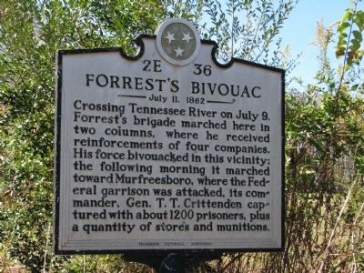
Forrest's Bivouac
July 11, 1862
Erected by TN Historical Commission. (Marker Number 2E 36.)
Topics and series. This historical marker is listed in this topic list: War, US Civil. In addition, it is included in the Tennessee Historical Commission series list. A significant historical month for this entry is July 2000.
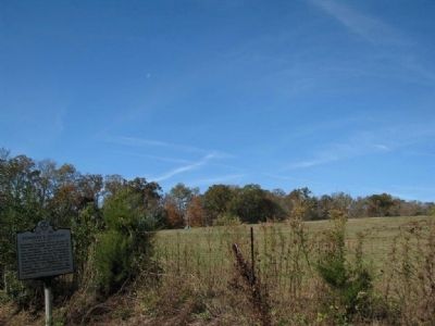
Location. 35° 43.992′ N, 85° 40.31′ W. Marker is in McMinnville, Tennessee, in Warren County. Marker is at the intersection of Old Rock Island Road (State Highway 288) and Mud Creek Road, on the right when traveling west on Old Rock Island Road. Touch for map. Marker is in this post office area: Rock Island TN 38581, United States of America. Touch for directions.
Other nearby markers. At least 8 other markers are within 6 miles of this marker, measured as the crow flies. Kentucky-Alabama Road (approx. 2.4 miles away); The Old Kentucky Road (approx. 4˝ miles away); The Birthing Tree (approx. 4.6 miles away); Cumberland Caverns (approx. 4.7 miles away); a different marker also named Cumberland Caverns (approx. 4.7 miles away); Clay Faulkner (approx. 5.2 miles away); Rodgers' Tavern (approx. 5.3 miles away); Webb Hotel (approx. 5.3 miles away). Touch for a list and map of all markers in McMinnville.
Related markers. Click here for a list of markers that are related to this marker. To better understand the relationship, study each marker in the order shown.
Also see . . . The Rock Martin House. Face Book entry (Submitted on November 2, 2010, by Tom Gillard of Tullahoma, Tennessee.)
Credits. This page was last revised on June 16, 2016. It was originally submitted on November 2, 2010, by Tom Gillard of Tullahoma, Tennessee. This page has been viewed 1,076 times since then and 25 times this year. Last updated on August 6, 2014, by Deanna Lack of Sparta, Tennessee. Photos: 1, 2, 3. submitted on November 2, 2010, by Tom Gillard of Tullahoma, Tennessee. • Al Wolf was the editor who published this page.


