St. Catharines in Niagara Region, Ontario — Central Canada (North America)
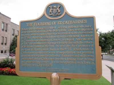
The Founding of St. Catharines
Inscription.
Before this region was settled, several Indian trails intersected here at a ford in Twelve Mile Creek. They were improved by early settlers and a church was erected at the crossroads by 1798. A tavern soon followed and a settlement, known as St. Catharines or Shipman's Corners, developed. After the War of 1812 the community expanded largely through the efforts of William Hamilton Merritt. He was the chief promoter of the First Welland Canal, built in 1824-33, which made St. Catharines a centre for water transportation and industry. Factories and mills were established and St. Catharines became a leading flour-milling and shipbuilding centre. It was incorporated as a Town in 1845 and as a City in 1876.
Erected by Ontario Heritage Foundation, Ministry of Culture and Recreation.
Topics. This historical marker is listed in these topic lists: Industry & Commerce • Settlements & Settlers. A significant historical year for this entry is 1798.
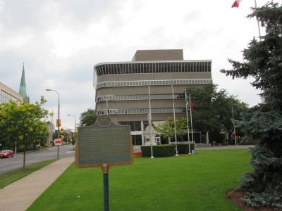
Location. 43° 9.575′ N, 79° 14.834′ W. Marker is in St. Catharines, Ontario, in Niagara Region. Marker is at the intersection of Church Street and James Street, on the right when traveling north on Church Street. Marker is on the front lawn of City Hall, just south of the intersection. Touch for map. Marker is at or near this postal address: 50 Church Street, St Catharines ON L2R 7C2, Canada. Touch for directions.
Other nearby markers. At least 8 other markers are within walking distance of this marker. City Hall 1937 (here, next to this marker); Private Alexander Watson (within shouting distance of this marker); St. Catharines (approx. half a kilometer away); Shipbuilding in St. Catharines 1845 (approx. half a kilometer away); St. Paul Street United Church (approx. half a kilometer away); In Memorium Reqviescant in Pace (approx. 0.6 kilometers away); Anglican Church, St. Catharines (approx. 0.6 kilometers away); William Hamilton Merritt 1793 - 1862 (approx. 0.6 kilometers away). Touch for a list and map of all markers in St. Catharines.
Credits. This page was last revised on September 27, 2019. It was originally submitted on August 9, 2014, by Anton Schwarzmueller of Wilson, New York. This page has been viewed 431 times since then and 19 times this year. Photos: 1, 2. submitted on August 9, 2014, by Anton Schwarzmueller of Wilson, New York. • William J. Toman was the editor who published this page.

