Richford in Tioga County, New York — The American Northeast (Mid-Atlantic)
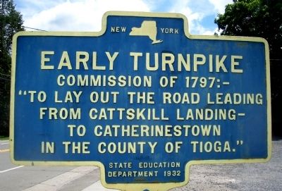
Early Turnpike
Erected 1932 by State Education Department.
Topics. This historical marker is listed in this topic list: Roads & Vehicles. A significant historical year for this entry is 1797.
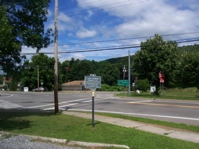
Location. 42° 21.366′ N, 76° 12.051′ W. Marker is in Richford, New York, in Tioga County. Marker is at the intersection of New York State Route 38 and New York State Route 79, on the right when traveling south on State Route 38. Touch for map. Marker is at or near this postal address: 13303 New York Highway 38, Richford NY 13835, United States of America. Touch for directions.
Other nearby markers. At least 8 other markers are within 6 miles of this marker, measured as the crow flies. Public Square (a few steps from this marker); The Old Abbey (within shouting distance of this marker); First Church (about 400 feet away, measured in a direct line); Berkshire (approx. 3˝ miles away); Old Rich Tavern (approx. 4.6 miles away); Cabin Site (approx. 4.8 miles away); The Widow Earsley (approx. 4.9 miles away); Home of Nathaniel Tobey (approx. 5.1 miles away). Touch for a list and map of all markers in Richford.
Credits. This page was last revised on June 16, 2016. It was originally submitted on August 10, 2014, by Forest McDermott of Masontown, Pennsylvania. This page has been viewed 349 times since then and 7 times this year. Photos: 1, 2. submitted on August 10, 2014, by Forest McDermott of Masontown, Pennsylvania. • Bill Pfingsten was the editor who published this page.

