Marker Logo HMdb.org THE HISTORICAL
MARKER DATABASE
“Bite-Size Bits of Local, National, and Global History”
Near Stafford in Stafford County, Virginia — The American South (Mid-Atlantic)
 

Patawomeck People at Belle Plains


Patawomeck People at Belle Plains Marker image. Click for full size.
Photographed By Kevin W., August 15, 2014
1. Patawomeck People at Belle Plains Marker
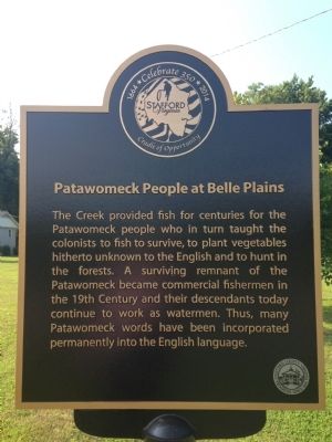
Inscription. The Creek provided fish for centuries for the Patawomeck people who in turn taught the colonists to fish to survive, to plant vegetables hitherto unknown to the English and to hunt in the forests. A surviving remnant of the Patawomeck became commercial fishermen in the 19th Century and their descendants today continue to work as watermen. Thus, many Patawomeck words have been incorporated permanently into the English language.
 
Erected 2014 by Stafford County.
 
Topics. This historical marker is listed in this topic list: Native Americans.
 
Location. 38° 20.488′ N, 77° 20.106′ W. Marker is near Stafford, Virginia, in Stafford County. Marker is on Belle Plains Road (County Route 604). Touch for map. Marker is in this post office area: Fredericksburg VA 22405, United States of America. Touch for directions.
 
Other nearby markers. At least 8 other markers are within 3 miles of this marker, measured as the crow flies. Crow's Nest (approx. 2 miles away); Crow's Nest Natural Area Preserve / Virginia’s State Natural Area Preserves (approx. 2 miles away); John Smith Explores the Chesapeake (approx. 2.1 miles away); Union Redoubt No. 3 (approx. 2.2 miles away); Union Redoubt # 3 (approx. 2.4 miles away); Battle of Aquia Landing (approx.
Paid Advertisement
Click on the ad for more information.
Please report objectionable advertising to the Editor.
Click or scan to see
this page online
2.9 miles away); Aquia Landing (approx. 2.9 miles away); Mason's Homestead (approx. 2.9 miles away). Touch for a list and map of all markers in Stafford.
 
Patawomeck People at Belle Plains Marker image. Click for full size.
Photographed By Kevin W., August 15, 2014
2. Patawomeck People at Belle Plains Marker
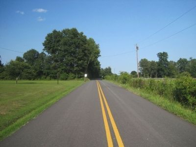
View of the marker (on left) facing Old Landing Point.
 
 
Credits. This page was last revised on June 16, 2016. It was originally submitted on August 15, 2014, by Kevin W. of Stafford, Virginia. This page has been viewed 576 times since then and 29 times this year. Photos:   1, 2. submitted on August 15, 2014, by Kevin W. of Stafford, Virginia.
Share this page.  
Share on Tumblr
m=76274

CeraNet Cloud Computing sponsors the Historical Marker Database.
This website earns income from purchases you make after using our links to Amazon.com. We appreciate your support.
Paid Advertisement
Apr. 19, 2024