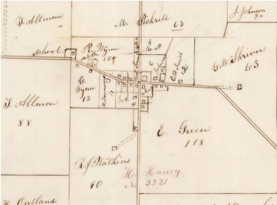
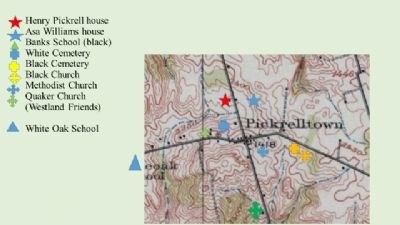
Near West Liberty in Logan County, Ohio — The American Midwest (Great Lakes)
Underground Railroad Station
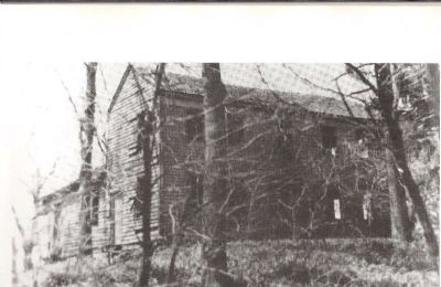
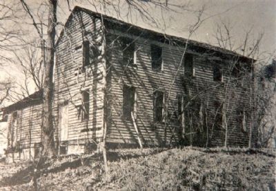
The Pickrell Mansion
— The Quakers of Monroe Twp., Logan County, Ohio —
(Side A)
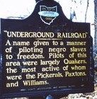
Underground Railroad A name given to a manner of piloting negro slaves to freedom. Pilots of this area were largely Quakers, the most active of whom were the Pickerells, Paxtons, and Williams.
(Side B)
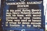
Underground Railroad Station At this point, during Slavery days, Henry Pickerell, Quaker, built his house with secret entrances to some rooms. These were used as havens of refuge for slaves enroute to freedom in the North.
Erected 1949 by Logan county Historical Society.
Topics and series. This historical marker is listed in these topic lists: Abolition & Underground RR • African Americans • Churches & Religion. In addition, it is included in the Quakerism series list.
Location. Marker has been reported missing. It was located near 40° 18.263′ N, 83° 39.73′ W. Marker was near West Liberty, Ohio, in Logan County. Marker was on County Route 28, one mile south of US 33. US 33 to St Rt 292 exit (inclues Co. Rds. 153, and 28) South on Co. Rd. 28, up “Cork Screw Hill” approx.. 1 mile to a grove of trees on right side. If you reach Pickrelltown (1 ¼ mile) , you missed it. Touch for map. Marker was at or near this postal address: 5271 County Road 28, West Liberty, Ohio, West Liberty OH 43357, United States of America. Touch for directions.
Other nearby markers. At least 8 other markers are within 2 miles of this location, measured as the crow flies. Pickrell UGRR Station (a few steps from this marker); Pickrelltown Community Club (approx. 0.3 miles away); Pickrelltown Monument Honor Roll (approx. 0.3 miles away); Monroe Township School (approx. 1½ miles away); Second Church/ First School (approx. 1.6 miles away); Goshen Quaker Cemetery (approx. 1.6 miles away); George Washington Rockwell (approx. 2 miles away); Hicksite Quaker Church (approx. 2.1 miles away). Touch for a list and map of all markers in West Liberty.
More about this marker. both marker and house are gone, Site consists of ruins in a wooded area.
Additional commentary.
1. Underground railroad marker, Pickerel Town Oh
I know who took these pictures of the markers for the underground railroad in Pickerelltown, Ohio! I did! My mother (Sarah Evalyn Park Turner) grew up in the house pictured on this site. I took the pictures of the markers prior to them being stolen (vandalized) in 1984.
— Submitted November 25, 2016, by Paul Eugene Turner of Kissimmee, Florida.
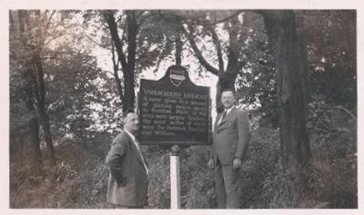
Logan County Historical Society, 11/1949
3. Erecting the Underground Railroad Station Marker
Rev. Guy Furby and Herman Marmon standing with the newly erected marker, September 11, 1949. Both men were instrumental in founding the Logan County Historical society. Both were personal friends and mentors.
Credits. This page was last revised on March 29, 2021. It was originally submitted on August 19, 2014, by Rev. Ronald Irick of West Liberty, Ohio. This page has been viewed 2,606 times since then and 73 times this year. Photos: 1, 2, 3, 4, 5, 6, 7. submitted on August 20, 2014, by Rev. Ronald Irick of West Liberty, Ohio. • Al Wolf was the editor who published this page.
