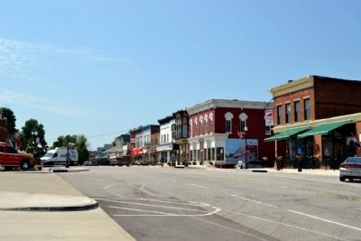
New Carlisle in St. Joseph County, Indiana — The American Midwest (Great Lakes)
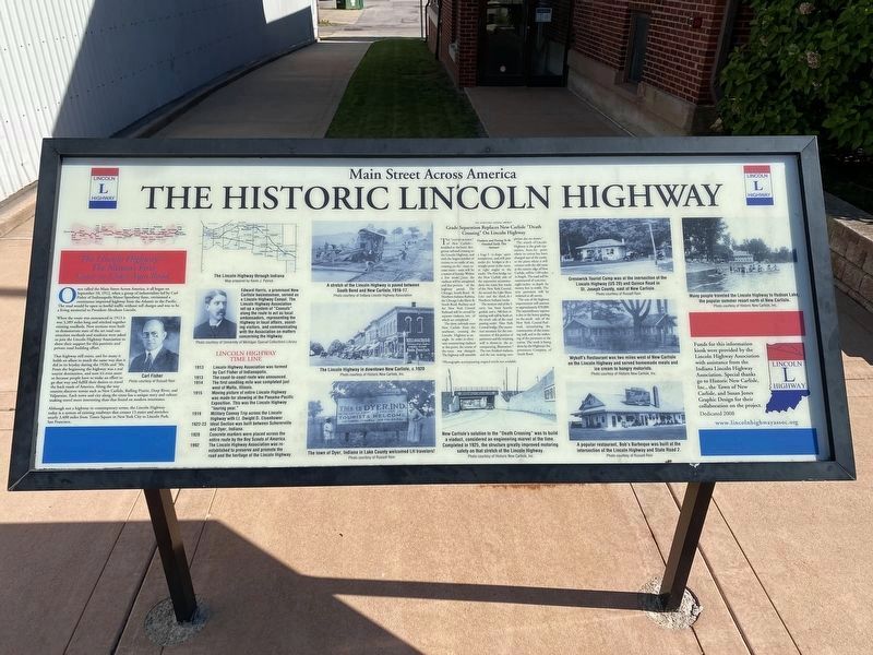
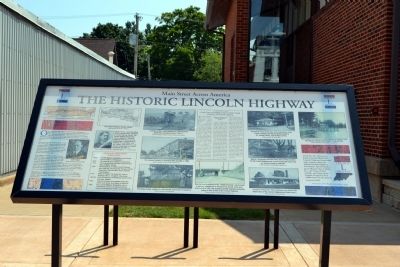
The Historic Lincoln Highway
Main Street Across America
The Nation’s First Coast-to-Coast Auto Road
When the route was announced in 1913 it was 3,389 miles long and stitched together existing roadbeds. New sections were built to demonstrate state of the art road construction methods and residents were asked to join the Lincoln Highway Association to show their support for this patriotic and private road building effort.
That highway still exists, and for many it holds an allure in much the same way that it did in its heyday during the 1920s and ’30s. From the beginning the highway was a real tourist destination, and now it’s even more so because people have to make an effort to go that way and fulfill their desires to travel the back roads of America. Along the way tourists discover towns such as New Carlisle, Rolling Prairie, Deep River, and Valparaiso. Each town and city along the route has a unique story and culture making travel more interesting than that found on modern interstates.
Although not a highway in contemporary terms, the Lincoln Highway today is a system of existing roadways that crosses 13 states and stretches nearly 3,400 miles from Times Square in New York city to Lincoln Park, San Francisco.
Lincoln Highway Time Line
1913 - Lincoln Highway Association was formed by Carl Fisher of Indianapolis.
1913 - The coast-to-coast route was announced.
1914 - The first seedling mile was completed just west of Malta, Illinois.
1915 - Moving picture of entire Lincoln Highway was made for showing at the Panama-Pacific Exposition. This was the Lincoln Highway “touring year.”
1919 - Military Convoy Trip across the Lincoln Highway with Lt. Dwight D. Eisenhower
1922-23 - Ideal Section was built between Schererville and Dyer, Indiana.
1928 - Concrete markers were placed across the entire route by the Boy Scouts of America.
1992 - The Lincoln Highway Association was re-established to preserve and promote the road and the heritage of the Lincoln Highway.
The Northern Indiana Motorist
Grade Separation Replaces New Carlisle “Death Crossing” On Lincoln Highway
Viaducts and Paving To Be Finished Early This Summer
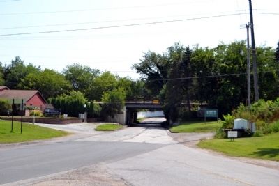
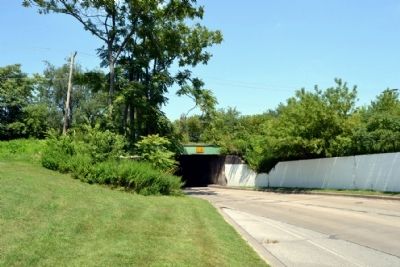
The “Death Crossing” of New Carlisle—heralded as the most dangerous railroad crossing on the Lincoln Highway, and with the largest number of victims to its credit of any crossing on the coast-to-coast route—soon will be a matter of history. Within a few weeks’ time the viaducts will be completed and that portion of the highway paved. The Chicago, South Bend & Northern Indiana Railway, the Chicago Lake Shore & South Bend Railway and the New York Central Railroad will be served by separate viaducts, two of which are completed.
The three railroads enter New Carlisle from the southeast, crossing the Lincoln Highway at an angle. In order to eliminate constructing viaducts at this point, the course of the route was changed. The highway will resemble a huge S in shape upon completion, and will pass under the bridges at the straight point in the curve, at right angles to the tracks. The first bridge on the New Carlisle side of the separation accommodates the main line tracks of the New York Central, the second the Lake Shore Line and the third, the Northern Indiana tracks.
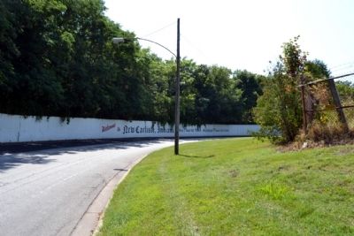
The western end of the S curve has been heavily graded and a 700-foot retaining wall will be built on the south side of the road passing under New York Central bridge. The excavation necessary for the construction of this portion of pavement and the retaining wall is shown in the accompanying illustration.* The two finished viaducts, and the one nearing completion also are
shown.*
The stretch of Lincoln Highway at the grade separation, from the point where its course has been changed east of the tracks to the point where it will connect with the old route at the eastern edge of New Carlisle, will be 1.09 miles in length. The road will be constructed of concrete, eight inches in depth by twenty feet in width. The new pavement will be widened at all curves.
The cost of the highway improvement will amount to approximately $70,000. The extraordinary expense is due to the heavy grading on the south side of the New York Central Railroad, necessitating the construction of the retaining wall, and to the widening of the pavement at the curves. The work is being done by the Highways Improvement Company of South Bend.
*Photographs accompanying original article not available.
Funds for this information kiosk were provided by the Lincoln Highway Association with assistance from the Indiana Lincoln Highway Association. Special thanks go to Historic New Carlisle, Inc., the Town of New Carlisle, and Susan Jones Graphic Design for their collaboration on the project.
Erected 2008 by Lincoln Highway Association with assistance from the Indiana Lincoln Highway Association.
Topics and series. This historical marker is listed in these topic lists: Bridges & Viaducts • Industry & Commerce • Railroads & Streetcars • Roads & Vehicles. In addition, it is included in the Former U.S. Presidents: #34 Dwight D. Eisenhower, and the Lincoln Highway series lists. A significant historical month for this entry is September 1973.
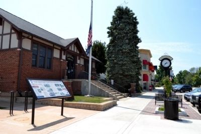
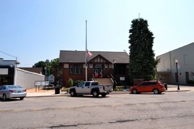
Location. 41° 42.373′ N, 86° 30.492′ W. Marker is in New Carlisle, Indiana, in St. Joseph County. Marker can be reached from East Michigan Street (U.S. 20) east of South Arch Street, on the left when traveling west. The marker stands in front of the New Carlisle Town Hall. Touch for map. Marker is at or near this postal address: 124 East Michigan Street, New Carlisle IN 46552, United States of America. Touch for directions.
Other nearby markers. At least 8 other markers are within 6 miles of this marker, measured as the crow flies. New Carlisle Founded (a few steps from this marker); New Carlisle World War II Honor Roll (a few steps from this marker); New Carlisle Civil War Memorial (approx. 0.9 miles away); Hamilton Methodist Church (approx. 2½ miles away); Hamilton Church Cemetery (approx. 2½ miles away); Rooted in Studebaker History (approx. 2.6 miles away);
Fort Wayne-Fort Dearborn Trail (approx. 5.4 miles away); Rolling Prairie School Honor Roll (approx. 5.7 miles away). Touch for a list and map of all markers in New Carlisle.
Also see . . .
1. The Lincoln Highway Association. Official website of the Lincoln Highway Association. (Submitted on August 20, 2014.)
2. Indiana Lincoln Highway Byway. Official website of the Indiana Lincoln Highway Association. Includes historic photograph of New Carlisle viaduct on front page. (Submitted on August 20, 2014.)
Credits. This page was last revised on April 2, 2024. It was originally submitted on August 20, 2014, by Duane Hall of Abilene, Texas. This page has been viewed 732 times since then and 58 times this year. Last updated on April 1, 2024, by Lou Donkle of Valparaiso, Indiana. Photos: 1. submitted on June 30, 2022, by Lou Donkle of Valparaiso, Indiana. 2, 3, 4, 5, 6, 7, 8, 9, 10. submitted on August 20, 2014, by Duane Hall of Abilene, Texas. • Devry Becker Jones was the editor who published this page.
