Bound Brook in Somerset County, New Jersey — The American Northeast (Mid-Atlantic)
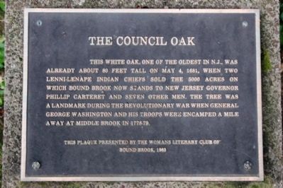
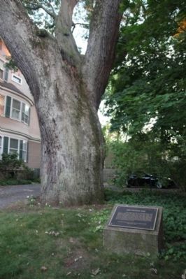
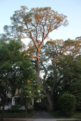
The Council Oak
Erected 1983 by Woman's Literary Club of Bound Brook.
Topics. This historical marker is listed in these topic lists: Colonial Era • Horticulture & Forestry • Native Americans • War, US Revolutionary. A significant historical month for this entry is May 1837.
Location. 40° 34.052′ N, 74° 31.853′ W. Marker is in Bound Brook, New Jersey, in Somerset County. Marker is on East Maple Avenue. Touch for map. Marker is in this post office area: Bound Brook NJ 08805, United States of America. Touch for directions.
Other nearby markers. At least 8 other markers are within walking distance of this marker. The Presbyterian Church at Bound Brook (about 300 feet away, measured in a direct line); Bound Brook Library World War I Memorial (approx. 0.3 miles away); The Frelinghuysen Tavern (approx. 0.4 miles away); Van Horn Plaza (approx. 0.4 miles away); Bound Brook World War I Memorial (approx. 0.4 miles away); Battle of Boundbrook (approx. 0.4 miles away); Old Stone Bridge (approx. half a mile away); Battle of Bound Brook (approx. half a mile away). Touch for a list and map of all markers in Bound Brook.
Credits. This page was last revised on June 16, 2016. It was originally submitted on August 22, 2014, by Somerset County Library Staff of Bridgewater, New Jersey. This page has been viewed 1,330 times since then and 101 times this year. Photos: 1, 2, 3. submitted on August 22, 2014, by Somerset County Library Staff of Bridgewater, New Jersey. • Bill Pfingsten was the editor who published this page.


