Wabash in Wabash County, Indiana — The American Midwest (Great Lakes)
Treaty of 1826 Meeting Camp
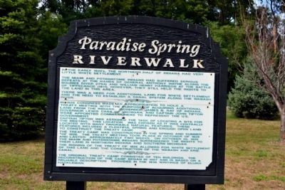
Paradise Spring Riverwalk
In the early 1820's, the northern half of Indiana had very little white settlement.
The Miami and Potawatomie Indians had suffered serious defeats at the hands of General Anthony Wayne along the Maumee River (1794) and William Henry Harrison at the Battle of Tippecanoe (1811). However, they still held the rights to the land in this area.
There was a need for additional land for white settlement and the need to establish a canal system along the Wabash River.
In 1826, Congress made an appropriation to hold a treaty meeting with the purpose of acquiring additional land from the Indians. Governor James B. Ray of Indiana, Governor Lewis Cass of Michigan, and Captain John Tipton were appointed commissioners to represent the U.S. government.
Captain Tipton was assigned the task of locating a site for the meeting. This location was chosen as it was centrally located with many favorable natural features. These features included a plentiful spring and enough open land to construct the treaty camp.
The treaty camp was constructed in the spring and summer of 1826. The treaty meeting took place in October of 1826 and lasted approximately two weeks. On October 26, 1826 the Miami and Potawatamie Indians surrendered the rights to their land in northern Indiana and southern Michigan.
The signing of the Treaty of 1826 allowed for white settlement of this land and the construction of the Wabash and Erie Canal.
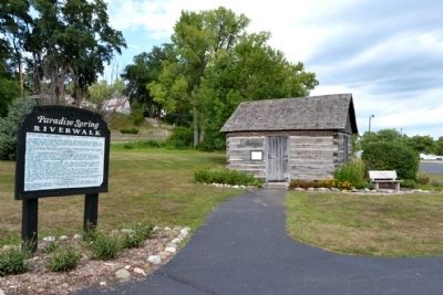
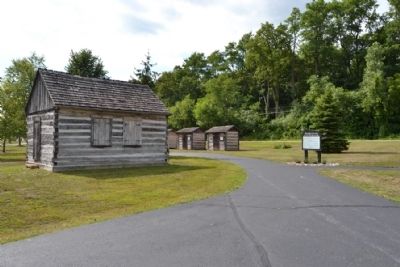
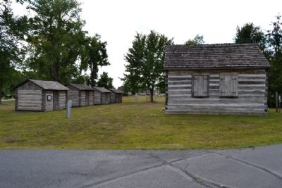
The original treaty camp consisted of ten buildings. The reconstruction of the camp began in 1987 and is based on a reliable description provided in the 1836 writings of Elijah Hackleman.
Topics and series. This historical marker is listed in these topic lists: Native Americans • Settlements & Settlers • Wars, US Indian. In addition, it is included in the Former U.S. Presidents: #09 William Henry Harrison series list. A significant historical month for this entry is October 1826.
Location. Marker has been reported permanently removed. It was located near 40° 47.834′ N, 85° 48.93′ W. Marker was in Wabash, Indiana, in Wabash County. Marker could be reached from E. Market Street, 0.2 miles east of S. Allen Street. Marker is located in the northern part of Paradise Spring Park west of the parking lot; the above directions are to the driveway to the park’s northeast parking lot. Touch for map. Marker was in this post office area: Wabash IN 46992, United States of America.
We have been informed that this sign or monument is no longer there and will not be replaced. This page is an archival view of what was.
Other nearby markers. At least 8 other markers
are within walking distance of this location. Kin-Com-A-Ong Spring (here, next to this marker); Cook's Cabin (a few steps from this marker); Council House (a few steps from this marker); Quarters of James B. Ray (a few steps from this marker); Quarters of Lewis Cass (a few steps from this marker); Storage Cabin (within shouting distance of this marker); Quarters of Major General John Tipton (within shouting distance of this marker); Quarters of Captain Frederick R. Kintner (within shouting distance of this marker). Touch for a list and map of all markers in Wabash.
Also see . . .
1. Treaty Grounds. Ingenweb website entry (Submitted on August 27, 2014.)
2. Treaty with the Creeks 1826. First Nation website entry (Submitted on December 3, 2021, by Larry Gertner of New York, New York.)
Credits. This page was last revised on February 12, 2023. It was originally submitted on August 27, 2014, by Duane Hall of Abilene, Texas. This page has been viewed 392 times since then and 24 times this year. Last updated on January 29, 2023, by Craig Doda of Napoleon, Ohio. Photos: 1, 2, 3, 4. submitted on August 27, 2014, by Duane Hall of Abilene, Texas. • J. Makali Bruton was the editor who published this page.


