King's Chapel and Beyond
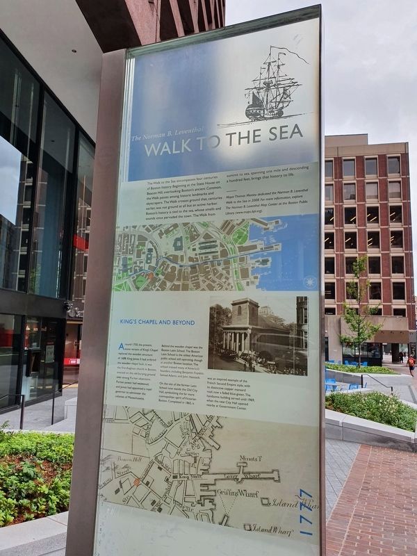
The Norman B. Leventhal Walk to the Sea
The Walk to the Sea encompasses four centuries of Boston history. Beginning at the State House on Beacon Hill, overlooking Boston's ancient Common, the Walk passes among historic landmarks and skyscrapers. The Walk crosses ground that, centuries earlier, was not ground at all but an active harbor. Boston's history is tied to the sea, whose smells and sounds once pervaded the town. The Walk from summit to sea, spanning one mile and descending a hundred feet, brings that history to life.
Mayor Thomas Menino dedicated the Norman B. Leventhal Walk to the Sea in 2008. For more information, explore The Norman B. Leventhal Map Center at the Boston Public Library (www.maps.bpl.org).
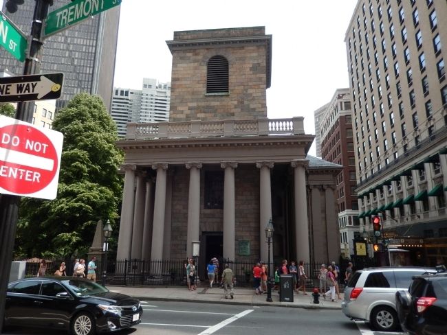
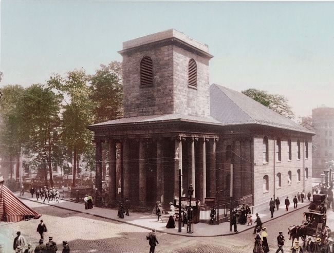
Around 1750, the present, stone version of King's Chapel replaced the wooden structure of 1688. King James II had ordered the wooden chapel built. It was the first Anglican church in Boston, erected on the old burying ground over strong Puritan objections. Puritan power had weakened, and James had appointed a royal governor to administer the colonies of Massachusetts.
Behind the wooden chapel was the Boston Latin School. The Boston Latin School is the oldest American public school still operating, though at another Boston location. The school trained many of America;s founders, including Benjamin Franklin, Samuel Adams, and John
Hancock.On the site of the former Latin School now stands the Old City Hall, symbolizing the far more cosmopolitan spirit of Victorian Boston. Completed in 1865, it was an inspired example of the French Second Empire style, with its distinctive copper mansard roof, now a faded blue-green. The handsome building served until 1969, when the new City Hall opened nearby at Government Center.
Reverse:
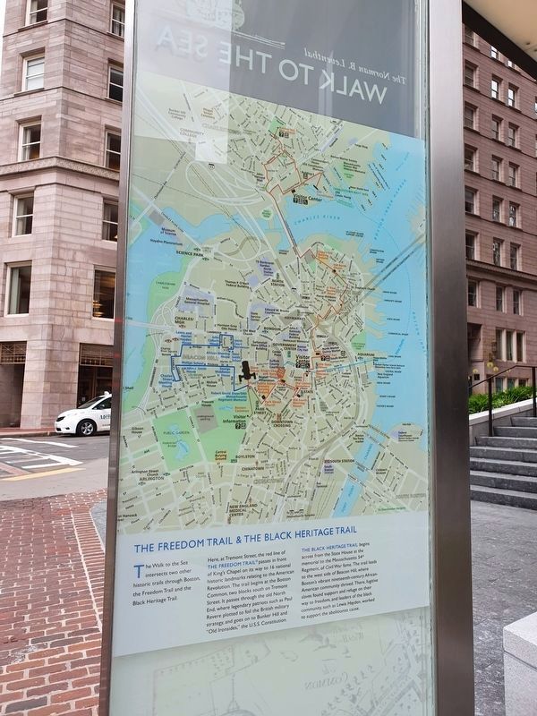
The Freedom Trail & The Black Heritage Trail
The Walk to the Sea intersects two other historic trails through Boston, the Freedom Trail and the Black Heritage Trail.
Here, at Tremont Street, the red line of The Freedom Trail® passes in front of King's Chapel on its way to 16 national
historic landmarks relating to the American Revolution. The trail begins at the Boston
Common, two blocks south on Tremont Street. It passes through the old North
End, where legendary patriots such as Paul Revere plotted to foil the British military
strategy, and goes on to Bunker Hill and "Old Ironsides," the U.S.S. Constitution.
The Black Heritage Trail begins across from the State House at the
memorial to the Massachusetts 54th Regiment of Civil War fame. The trail leads
to the west side of Beacon Hill, where Boston's vibrant nineteenth-century African-
American community thrived. There, fugitive
slaves found support and refuge on their
way to freedom and leaders
Erected by City of Boston.
Topics. This historical marker is listed in these topic lists: Churches & Religion • Notable Buildings. A significant historical year for this entry is 1750.
Location. 42° 21.482′ N, 71° 3.628′ W. Marker is in Boston, Massachusetts, in Suffolk County. It is in Downtown. Marker is at the intersection of Beacon Street and Tremont Street on Beacon Street. Touch for map. Marker is in this post office area: Boston MA 02108, United States of America. Touch for directions.
Other nearby markers. At least 8 other markers are within walking distance of this marker. North Church Tower (a few steps from this marker); King's Chapel (a few steps from this marker); The Chevalier de Saint Sauveur (within shouting distance of this marker); Life and Death in Colonial Boston (within shouting distance of this marker); Omni Hotels: The Parker House (within shouting distance of this marker); a different marker also named King's Chapel (within shouting distance of this marker); King’s Chapel Burial Ground (within shouting distance of this marker); Welcome to King’s Chapel Burying Ground (within shouting distance of this marker). Touch for a list and map of all markers in Boston.
Credits. This page was last revised on January 30, 2023. It was originally submitted on August 28, 2014, by Bill Pfingsten of Bel Air, Maryland. This page has been viewed 428 times since then and 21 times this year. Last updated on January 5, 2020, by Bruce Guthrie of Silver Spring, Maryland. Photos: 1, 2, 3. submitted on June 29, 2021, by J. Makali Bruton of Accra, Ghana. 4. submitted on August 28, 2014, by Bill Pfingsten of Bel Air, Maryland. 5. submitted on August 29, 2015. • Michael Herrick was the editor who published this page.
