Dorchester in Saline County, Nebraska — The American Midwest (Upper Plains)
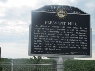
Pleasant Hill
Erected 2009 by BSA Troop 212; The Warren Cerny Family; Nebraska State Historical Society. (Marker Number 473.)
Topics and series. This historical marker is listed in this topic list: Settlements & Settlers. In addition, it is included in the Nebraska State Historical Society series list. A significant historical year for this entry is 1867.
Location. 40° 35.35′ N, 97° 5.637′ W. Marker is in Dorchester, Nebraska, in Saline County. Marker is on County Route HH, half a mile west of County Route 1600, on the left when traveling west. Marker is at the entrance to Pleasant Hill Cemetery. Touch for map. Marker is in this post office area: Dorchester NE 68343, United States of America. Touch for directions.
Other nearby markers. At least 8 other markers are within 13 miles of this marker, measured as the crow flies. PFC Charley Havlat (approx. 4 miles away); Erected to the memory of Bohemian pioneers in Saline County, Nebraska (approx. 7 miles away); Doane College (approx. 7.8 miles away); Gates College (approx. 7.8 miles away); Navy Department - United States of America (approx. 8.1 miles away); Hotel Wilber (approx. 10.1 miles away); Czech Capital (approx. 10.2 miles away); Historic Milford (approx. 12.9 miles away).
Credits. This page was last revised on June 16, 2016. It was originally submitted on September 1, 2014, by Joan Shurtliff of Seward, Nebraska. This page has been viewed 443 times since then and 18 times this year. Photos: 1. submitted on September 1, 2014, by Joan Shurtliff of Seward, Nebraska. 2. submitted on September 8, 2014, by Joan Shurtliff of Seward, Nebraska. • Bill Pfingsten was the editor who published this page.

