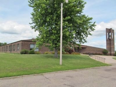
Near Sunburg in Kandiyohi County, Minnesota — The American Midwest (Upper Plains)
U.S. Military Post
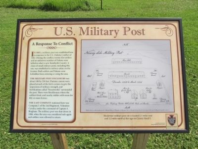
In 1865, a military post was established here in response to the U.S.-Dakota Conflict of 1862. During the conflict, twenty-five settlers and an unknown number of Dakota were killed in what is now Kandiyohi County. A chain of small military posts, including this one, was established to enforce safety on the frontier. Both settlers and Dakota were forbidden from entering or using the area.
The military post enclosure was about 100 by 250 feet. Dummy canons were placed at each of the fort's corners to give the impression of military strength, and fortifications called "breastworks" surrounded the post. There were blockhouses where the soldiers lived, and nearby stables with room for fifty or more horses.
The last company stationed here was Company L of the 2nd Regiment, Volunteer Cavalry, under the command of Captain S. Bingham. The military post was shut down in 1866, when the area was considered safe again and settlers were allowed to return.
Illustration Courtesy of Robin Freese
Glacial Ridge Trail Scenic Byway
Funded in part by the Federal Highway Administration
Erected by the Glacial Ridge Trail Scenic Byway Project.
Topics. This historical marker is listed in these topic lists: Forts and Castles • Wars, US Indian. A significant historical year for this entry is 1865.
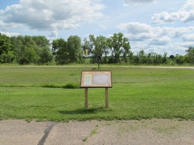
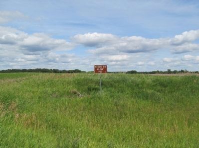
Location. 45° 17.794′ N, 95° 7.804′ W. Marker is near Sunburg, Minnesota, in Kandiyohi County. Marker can be reached from 180th Avenue Northwest (County Highway 40) 1.1 miles east of 80th Street Northwest (County Highway 1), on the left when traveling east. Marker is along the parking lot of the First Lutheran Church of Norway Lake. Touch for map. Marker is at or near this postal address: 6338 County Road 40 Northwest, New London MN 56273, United States of America. Touch for directions.
Other nearby markers. At least 8 other markers are within 8 miles of this marker, measured as the crow flies. Isle of Refuge (about 300 feet away, measured in a direct line); Jericho (approx. 0.9 miles away); The Old Log Church (approx. 2.6 miles away); a different marker also named Old Log Church (approx. 2.6 miles away); Lake Florida Mission Covenant Church (approx. 3.1 miles away); Johannes Iverson (approx. 3.8 miles away); Lundborg Cabin (approx. 5.3 miles away); Broberg Cabin Massacre Site (approx. 7.2 miles away). Touch for a list and map of all markers in Sunburg.
More about this marker. In August 1862, the Minnesota Dakota, also known by the French term, “Sioux," waged war against the United States following two years of unfulfilled treaty obligations. After attacking the Redwood (Lower Sioux) Agency, a remote government outpost, the Dakota moved with speed and surprise in southwestern Minnesota and what was then eastern Dakota Territory, killing nearly everyone in their path. They killed approximately 800 settlers and soldiers, took many prisoners, and caused extensive property damage throughout the Minnesota River Valley. Until the terrorist attacks of September 11, 2001, this was the highest civilian wartime toll in U.S. history.
Also see . . . 1862 Dakota War. "It was the largest Indian war in American history. The main battleground was the entire Minnesota River Valley in southern and central Minnesota. The uprising spread into the Dakota Territories and sent panic into Nebraska, Iowa and Wisconsin." (Submitted on September 2, 2014.)
Additional keywords. Norway Lake Military Post; U.S.-Dakota War of 1862
Credits. This page was last revised on June 16, 2016. It was originally submitted on September 2, 2014, by Keith L of Wisconsin Rapids, Wisconsin. This page has been viewed 642 times since then and 31 times this year. Photos: 1, 2, 3, 4, 5. submitted on September 2, 2014, by Keith L of Wisconsin Rapids, Wisconsin.
